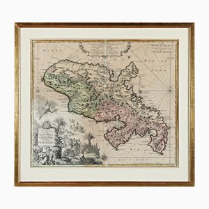
Martinique, Original Early Map: Representation la plus nouvelle et exacte De L'Ile Martinique, la premiere des Iles Del' Amerique Antilles...,1741, Original Hand Colored Copperplate Engraving
$824
You are now following Charts. You can manage alerts in your account settings.
You have unfollowed Charts.
Martinique, Original Early Map: Representation la plus nouvelle et exacte De L'Ile Martinique, la premiere des Iles Del' Amerique Antilles...,1741, Original Hand Colored Copperplate Engraving
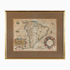
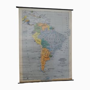
America Meridionalis, Early Map of South America by Gerard Mercator and Jodocus Hondius, 1610, Original Hand Colored Copperplate Engraving
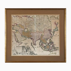
Early Map of Asia: Exactissima Asiae Delineatio in Praecipuas Regiones Original Hand Colored Copperplate Engraving by Carel Allard, 1694
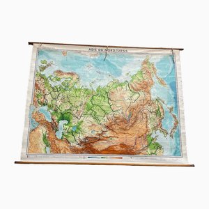
USSR School Chart
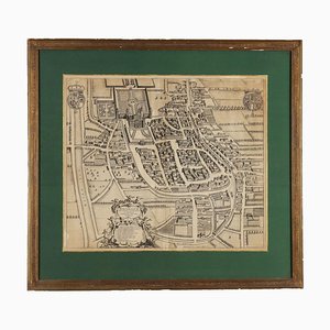
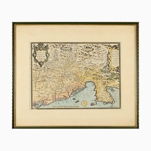
Etching with Map of Racconigi, 1726
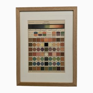
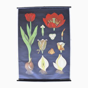
Illustrated Encyclopedia Color Plate, 1900, Color Engraving
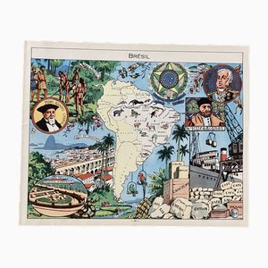
Illustrated Map of Brazil by Émile-Joseph-Porphyre Pinchon, 1948
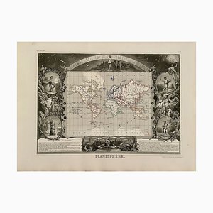
Planisphere World Map, 1849
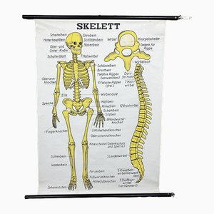
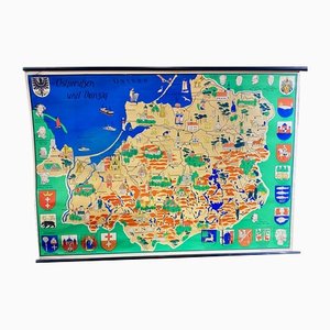
Vintage School Wall Chart
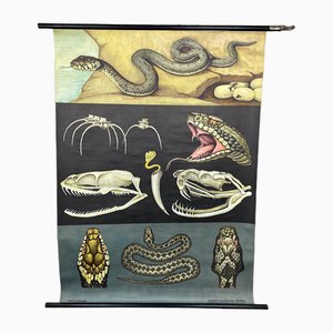
Vintage School Chart by Young, Koch & Quentell for Hagemann, 1970s
Vintage School Chart by Jung, Koch & Quentell for Hagemann, 1970s
Vintage Wall Chart by Jung, Koch & Quentell for Hagemann, 1970s
Vintage School Wall Chart
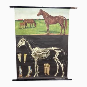
Vintage School Wall Chart by Jung, Koch & Quentell for Hagemann, 1970s
Vintage School Wall Chart
Vintage School Wall Chart
Vintage School Wall Chart by Jung, Koch & Quentell for Hagemann, 1970s
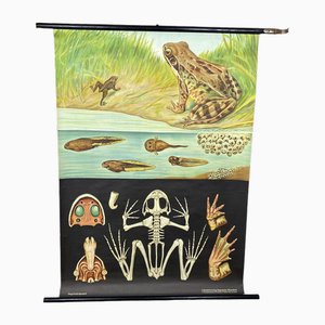
VintageSchool Chart by Jung, Koch & Quentell for Hagemann, 1970s
Vintage School Chart by Jung, Koch & Quentell for Hagemann, 1970s
Vintage School Wall Chart by Jung, Koch & Quentell for Hagemann, 1970s
School Poster by Jung, Koch & Quentell for Hagemann, 1960s
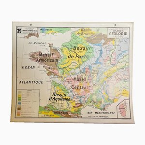
Map of France, 1960s
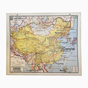
Map of China, 1960s
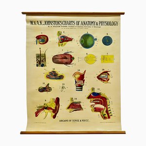
Large University Anatomical Chart of Organs of Sense & Voice by Dr. William Turner, 1920s
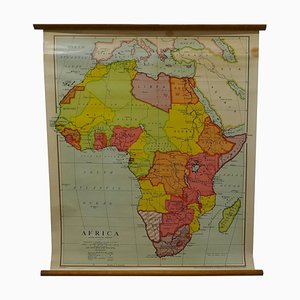
Large University Chart Physical Map of Africa by Bacon, 1920s
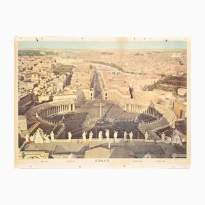
School Wall Chart of Rome, 1960s
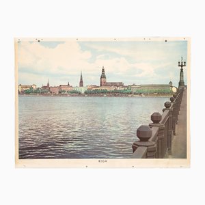
School Wall Chart of Riga, 1960s
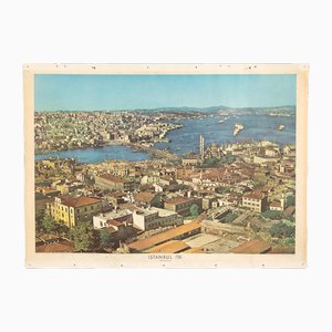
City Istanbul School Wall Panel, 1960s
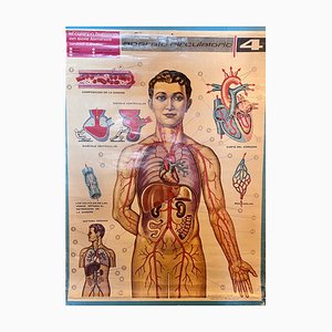
Human Body Circulatory System Poster, 1964
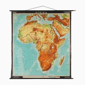
Large Africa School Map, 1950s
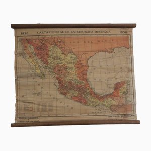
Mexican Republic Map, 1950s
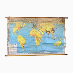
Population Distribution and Density Map, 1960s
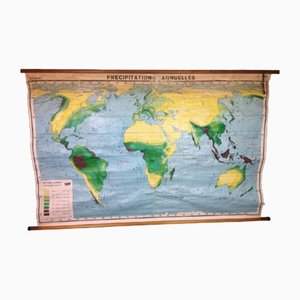
Annual Rainfall Map, 1960s
Pull-Down Chart, 1960s
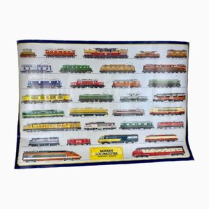
Trains Poster, 1985
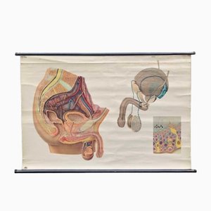
Male Anatomy Poster or Pull-Down Chart, 1950s
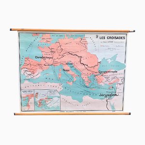
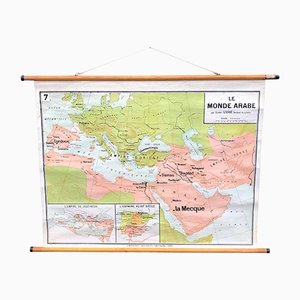
The Arabic World Pull Down Chart, 1960s
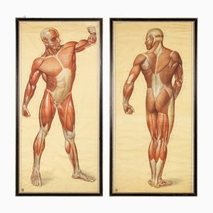
Anatomical Human Muscular Structure Charts by Tanck & Wagelin, 1950, Set of 2
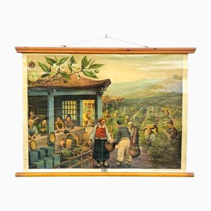
Vintage School Wall Chart, 1950s
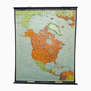
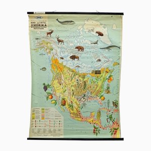
Vintage Countries of North America Mural Poster, 1970s
North America Land Use and Livestock Picture Map, 1970s
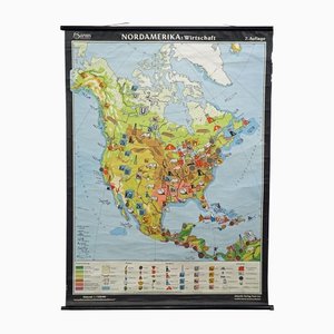
Vintage North America Economy Map, 1970s
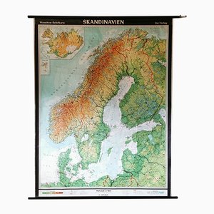
Mid-Century Relief Wall Card of Scandinavia by Wenschow for List Verlag, 1960s
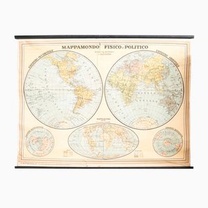
Vintage Political Chart
Southern America Map from IGDA Officine grafiche Novara, 1975
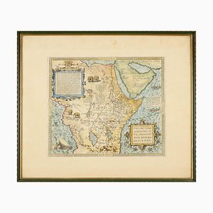
A. Ortelius, Theatrum Orbis Terrarum, 1573, Watercolored Etching, Framed
A. Ortelius, Theatrum Orbis Terrarum, 1572, Watercolored Etching, Framed
Vintage German Map
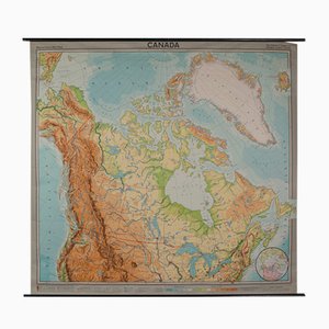
Vintage German Map of Canada
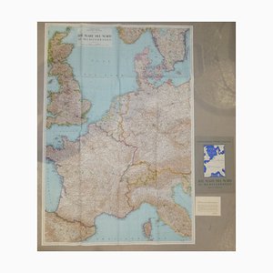
Opera Cartographic Mirabile Card from North Sea to the Mediterranean and Ethnographic Europe from C. T. I. Milan, Italy, 1939, Set of 3
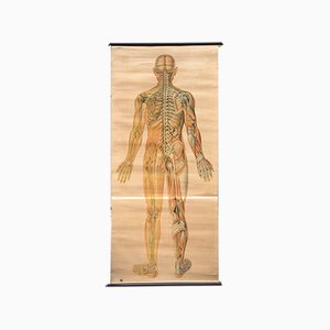
Anatomical Chart from the German Hygiene Museum, Dresden, Germany, 1950s
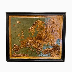
Relief Map of Europe by F. Dufour
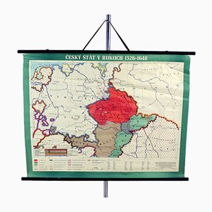
Vintage School Map of Czech State, Czechoslovakia, 1960s
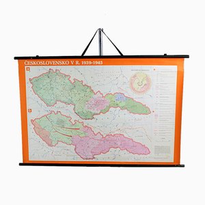
Vintage School Map of Czechoslovakia in 1939 1945, 1960s
Antique Globe by Hammet and Bacon, 1910s

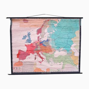
Vintage School Europe Wall Map by Leisering & Schulze for Velhagen, 1950s

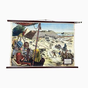
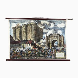
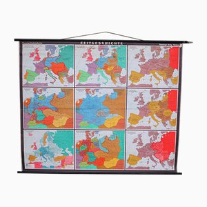
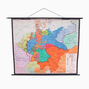
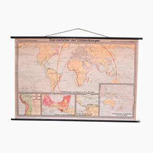
Large School Teaching Map on Contemporary History from Flemming Verlag Hamburg, 1950s
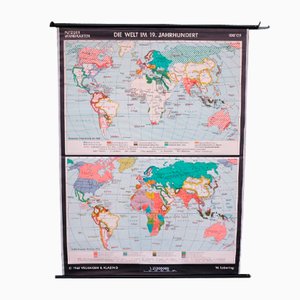
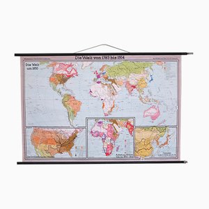
School Teaching World Map of the 19th Century from Velhagen & Klosing, 1961
School Teaching Map by Prof. Dr. W. Trillmich for Westermann Landkarten, 1950s
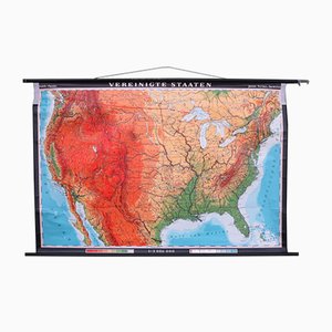
School Teaching Map of the USA from Justus Perthes Darmstadt, 1960s
School Teaching Map of Germany from Flemming Verlag, 1950s
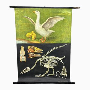
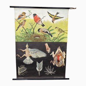
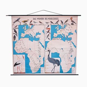
School Teaching Map of Birds from Verlag Jaeger Darmstadt, 1950s
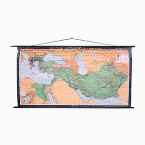
School Teaching Map by Prof. Dr. Lauffer for Justus Perthos Darmstadt, 1950s
School Teaching Map of North Africa from Westermann Verlag, 1950s

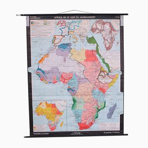
School Wall Map of Africa by Leisering & Schulze for Velhagen & Klasing, 1950s
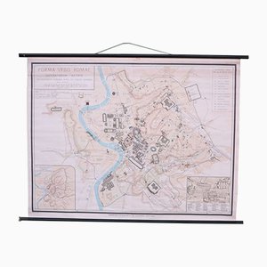
School Wall Map of Old Rome from Instituto Geografico de Agostini Nora, 1950s
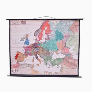
School Wall Map of Europe by Prof. Dr. Schmidt for Perthas Gotha, 1950s
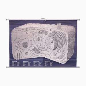
School Wall Map on Human Cells from Klett Verlag Stuttgart, 1976
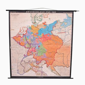
School Wall Map of Germany by Haach Hertzburg for Perthes Darmstadt, 1950s
School Wall Map of Central Europe by Dr. W. Trillmich for Westermann Verlag, 1960s

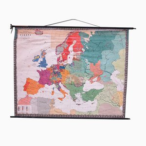
School Wall Map of Europe by Prof. Dr. M. G. Schmidt for Perthas Gotha, 1950s
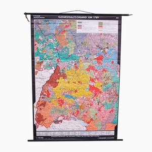
School Wall Map of South West Germany by Putzger for Velhagen & Klasing, 1950s
School Wall World Map by Haferland & Trillmich for Westermann, 1950s
Vintage College World Map by Perthes Darmstadt, 1950s
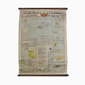
Map of Portugal and Overseas, 1960s
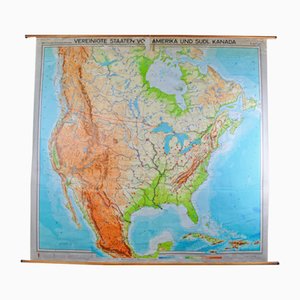
Map of United States by Georg Westermann, 1966
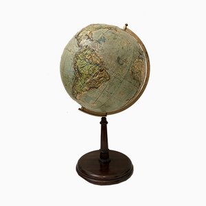
Vintage Relief Globe from Vallardi
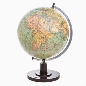
German Art Deco Globe from Columbus Verlag, 1941
Trending