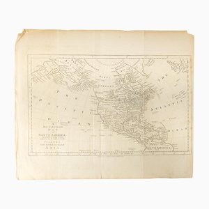
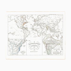
18th Century Map of North America, United States, and Asia by Bowen Thomas and Charles Cooke
$360
You are now following Charts. You can manage alerts in your account settings.
You have unfollowed Charts.
18th Century Map of North America, United States, and Asia by Bowen Thomas and Charles Cooke
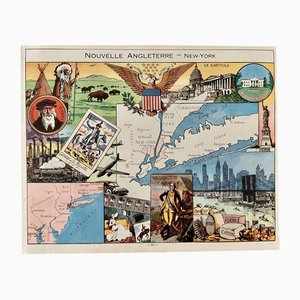
Illustrated Map of New York by Émile-Joseph-Porphyre Pinchon, 1948
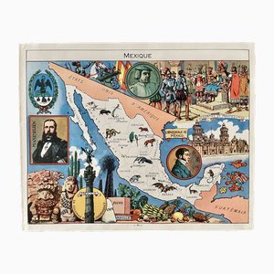
Illustrated Map of Mexico by Émile-Joseph-Porphyre Pinchon, 1948
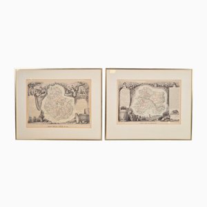
Antique Levasseur La Marne & Cote d'Or Wine Maps, 1852, Set of 2
American Red Cross Map of Italy, First World War, 1919

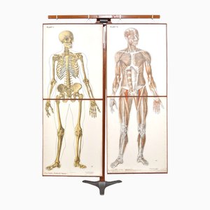
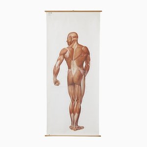
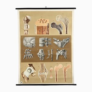
Human Foldable Anatomical Wall Charts, 1920s, Set of 2
Antique Naval Map of Australia, 1888

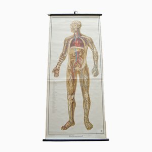
Blood Circulation Anatomic Wall Chart from German Health Museum Cologne, 1952
19th Century Map of Africa Etching

Vintage Botanical Wall Chart by Jung, Koch, & Quentell for Hagemann, 1970s

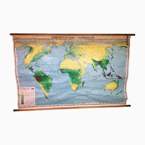
Annual Rainfall Map, 1960s
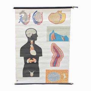
Pull-Down Chart of Endocrine System, 1970s
Large Anatomical Wall Chart from Deutsche Hygiene Museum, Dresden, 1992
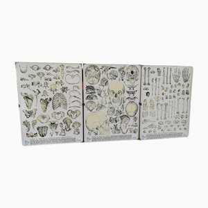
Vintage Skeleton Prints, 1960s, Set of 3
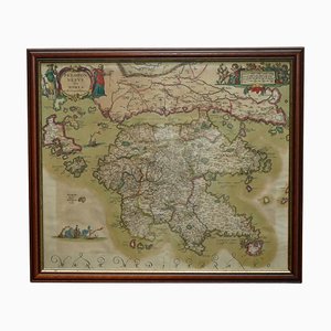
Cartographic Map of the Russian Empire by Frederick De Wit, 17th Century

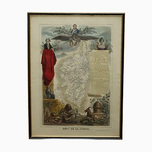
French Hand Watercolour Map of Dept des la Corse, 1856
Peloponnesus Sive Morea I Laurenbergio Greece Watercolour Map by Jan Jansson, 1660
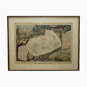
French Hand Watercolour Map of Dept des Hautes Pyrenees, 1856

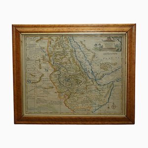
Watercolour Map of East Africa by Eman Bowen, London, 1744
French Hand Watercolour Map of Dept des Hautes Pyrenees, 1856
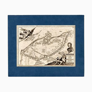
Charles XII Plan of Narva and Ivangorod During the Northern War
Anatomical Construction of the Bone Chart, 1960s
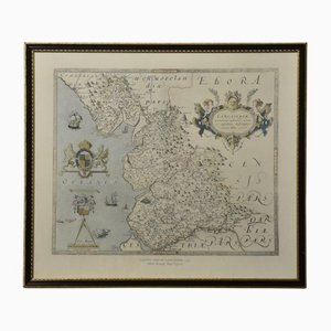
Map of Lancashire
Northwest Coast and Isle of Man Map

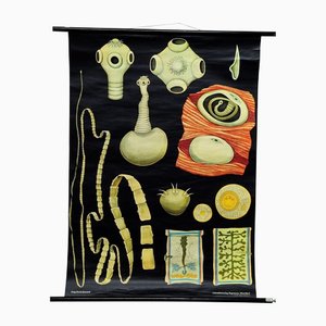
Tapeworm Rollable Wallchart by Jung Koch Quentell
Human Metabolism Body Excretion Water Balance Medical Wall Chart

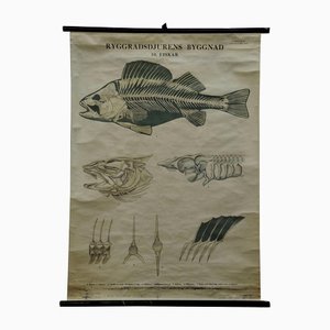
Vintage Swedish Black and White Skeleton of a Fish Rollable Wall Chart
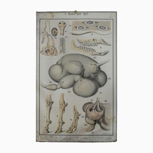
Old Home and Garden Anatomical Farm Animal Wall Chart Print
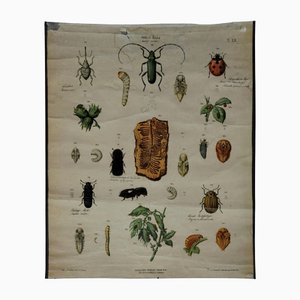
Old Vintage Beetles Insects Overview Wall Chart Poster
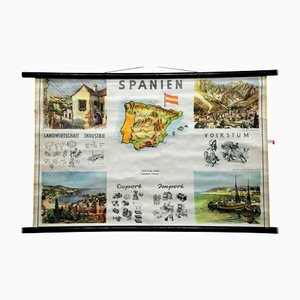
Spain Landscape Culture Souvenir Rollable Map Poster Wall Chart
Vintage Cottage Core Mushroom Rollable Poster Print Wall Chart by Jung Koch Quentell

Frederick Dewitt, Map, Engraved, Framed
Deed of Sale, Watercolor Plan of the Land of 1912

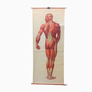
Vintage School Board "Muscle of Man", Germany, 1950s
Old British Empire Map - Ancient Map by Karl Spruner - 1760 ca. 1760 ca.
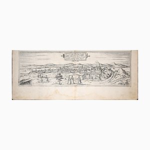
Buda, Antique Map from ''Civitates Orbis Terrarum'' - 1572-1617 1572-1617
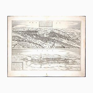
Prague and Egra, Antique Map from ''Civitates Orbis Terrarum'' - 1572-1617 1572-1617
Trending