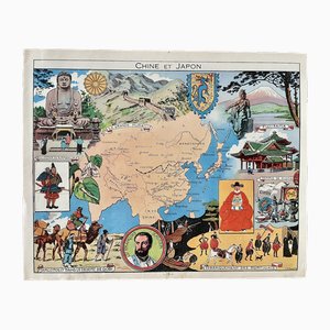
Illustrated Map of China and Japan by Émile-Joseph-Porphyre Pinchon, 1948
$125
You are now following Charts. You can manage alerts in your account settings.
You have unfollowed Charts.
Illustrated Map of China and Japan by Émile-Joseph-Porphyre Pinchon, 1948
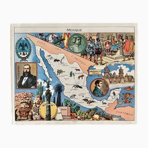
Illustrated Map of Mexico by Émile-Joseph-Porphyre Pinchon, 1948
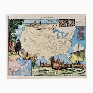
Illustrated Map of the United States by Émile-Joseph-Porphyre Pinchon, 1948
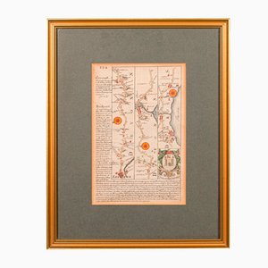
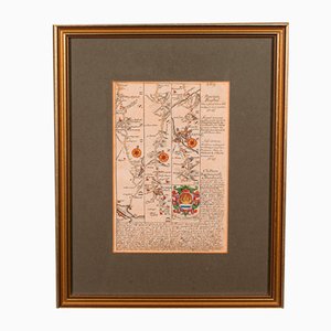
Antique English Chart of Devon
Antique English Coaching Road Map
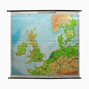
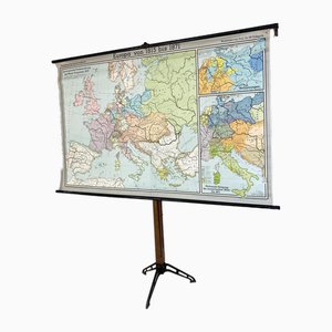
Europe Mural Map, 1970s
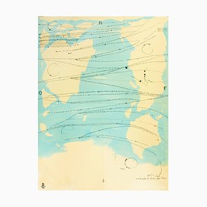
Vintage Mural Map or Wall Chart of North Atlantic, 1970s
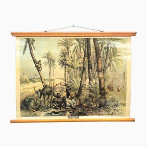
Vintage School Wall Chart by Jung, Koch & Quentell for Hagemann, 1972
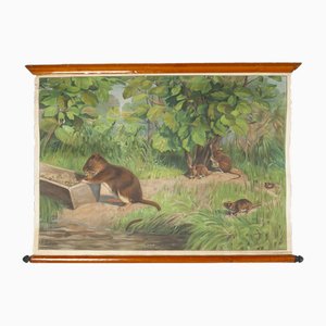
Vintage School Wall Chart, 1950s
Large Vintage Colourful Europe School Map, 1960s
American Red Cross Map of Italy, First World War, 1919

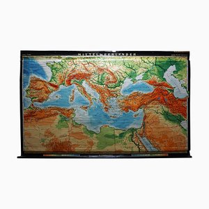
Vintage Mural Map Mediterranean Sea Near East Countries Rollable Wall Chart, 1970s

Vintage Rollable Map Mediterranean Countries Wall Chart Mural Poster, 1970s
Räuvögel Chart by Jung Koch Quentell

European Wall Chart, 1970s
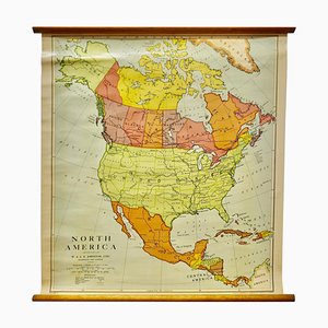
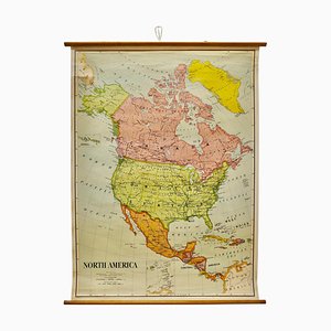
Large University Chart Political Map of North America by Bacon, 1920s
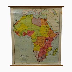
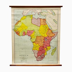
Large University Chart Physical Map of Africa by Bacon, 1920s
Large University Chart Political Map of North America by Bacon, 1920s
Vintage Landscape Wall Chart, 1970

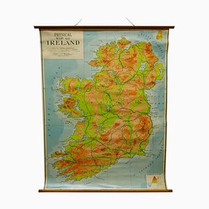
Large University Chart Physical Map of Ireland by Bacon, 1920s
Large University Chart Africa by Bacon, 1920s
Vintage School Poster Canteens by Young, Koch & Quentell for Hagemann, 1970s
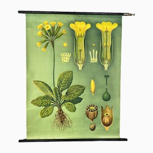
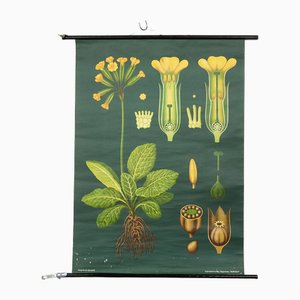
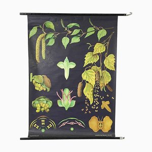
Vintage Botanical Wall Chart by Jung, Koch, & Quentell for Hagemann, 1970s
Vintage Botanical Wall Chart by Jung, Koch, & Quentell for Hagemann, 1960s
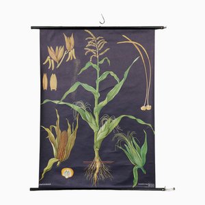
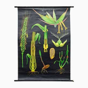
Botanical Corn Wall Chart by Jung, Koch, & Quentell for Hagemann, 1960s
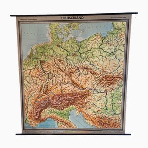
Large Vintage German Linen School Map of Central Europe, 1960s
Canvas Print of Rodents After Antonio Vallardi
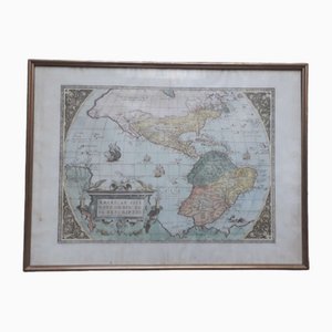
Antique Watercolor Print Map or the Americas, 1890s
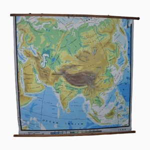
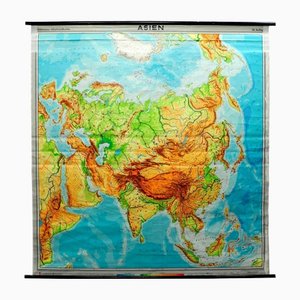
Physical Map of Asia, 1960s
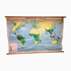
Annual Rainfall Map, 1960s
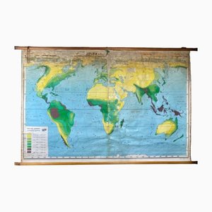
Annual Rainfall Map, 1960s
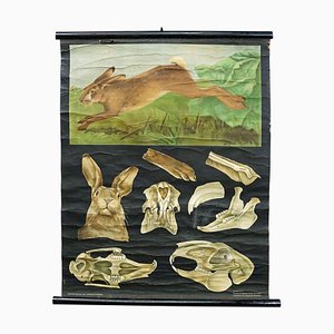
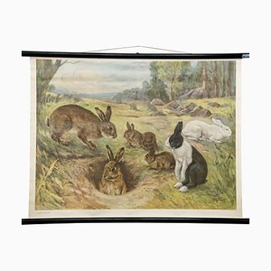
Hare Rabbit Countrylife Wall ChartJung Koch Quentell, 1960s
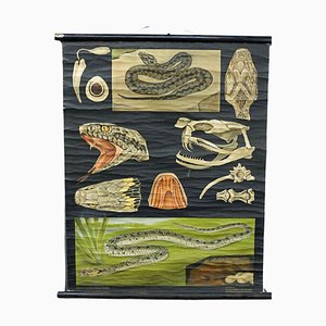
Snake Serpent Wall Chart from Jung Koch Quentell, 1960s
Maikchafer Botanical School Chart from Jung, Koch & Quentell for Hagemann Düsseldorf, 1970s

Sunflower Botanical Wall Chart by Jung, Koch & Quentell for Hagemann Düsseldorf, 1973

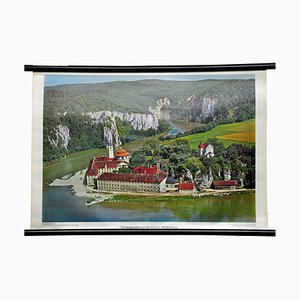
Vintage Photo Wall Chart of the Danubian Breach
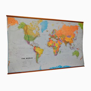
World Map in Laminated Paper
Vintage Mural Rollable Animal Wall Chart Rabbit Bunny Poster
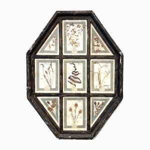
Vintage Herbarium in Glazed Wooden Frames, Florence, 1941
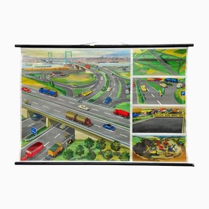
Highway Junction Rollable Wall Chart
Pull-Down Print Map of Asia
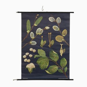
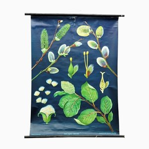
Pussy Willow Salix Caprea Wall Chart Picture Poster by Jung Koch Quentell
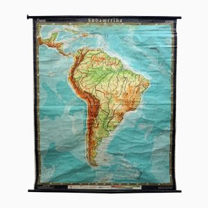
Vintage South America American Continent Pull Down Map
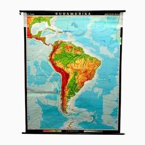
Vintage South America Pull Down Map Wall Chart Poster
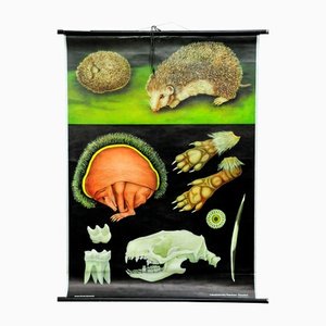
Vintage Hedgehog Rollable Wall Chart Poster Print by Jung Koch Quentell
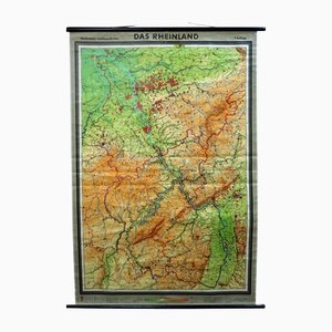
Vintage German Rhineland Map Rollable Wall Chart Poster Print
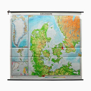
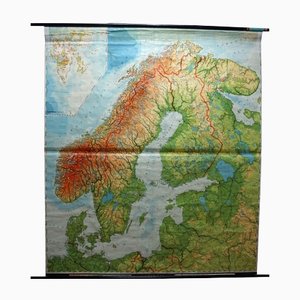
Vintage Scandinavia Norway Sweden Finland Rollable Map Wall Chart Print
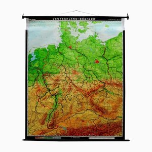
Vintage Germany BRD / DDR History Wall Chart Pull-Down Map
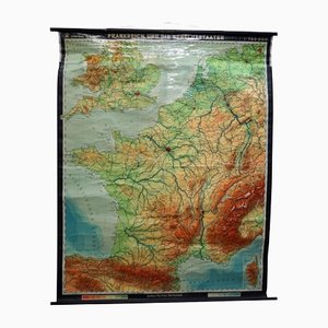
Vintage France Benelux Countries, South England Rollable Map Wall Chart
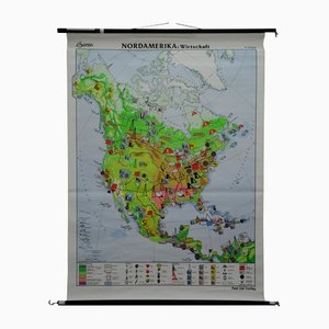
Vintage North America Economy Finances Pull Down Wall Chart
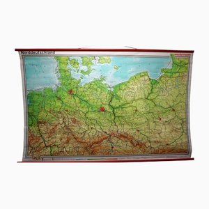
Vintage Northern Germany Poland Seaside Baltic Sea Rollable Map Wall Chart
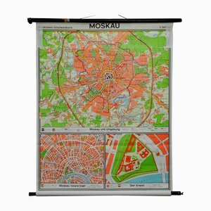
Vintage City Map of Moscow Pull Down Wall Chart
Vintage Rye Rollable Wall Chart Picture Poster by Jung Koch Quentell
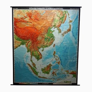
Vintage Southeast Asia China Japan Wall Chart Rollable Map
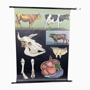
Vintage Biology Animals Carp Maritime Decor School Wall Chart by Jung Koch Quentell

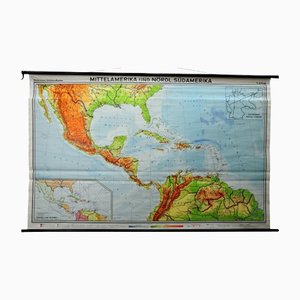
Large Central America Northern South America Wall Chart Poster Rollable Map
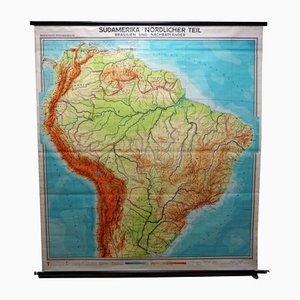
Vintage South America Brasilia and Neighbour States Rollable Map Wall Chart
Quentell Freshwater Algae Plants Maritime Decoration by Pull-Down Wall Chart

West German Botanical Biology Chart from Hagemann, Germany, 1964
Franz Hogenberg - Map of Meissen - Original Etching - Late 16th Century
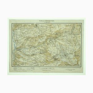
Unknown - Map of Vallombrosa - Florence 1926
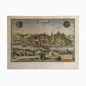
Limbourg, Antique Map from ''Civitates Orbis Terrarum'' 1572-1617

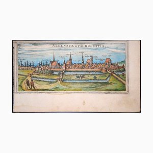
Stade, Antique Map from ''Civitates Orbis Terrarum'' - by F.Hogenberg - 1572-1617 1572-1617
Little world map Rome Peking, Olympic Games Beijing 2008 2008
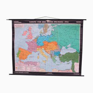
School Wall Map of Europe by W. Leisering for Velhagen & Klasing, 1950s
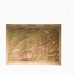
Vintage Geographical Map of Switzerland, 1930s
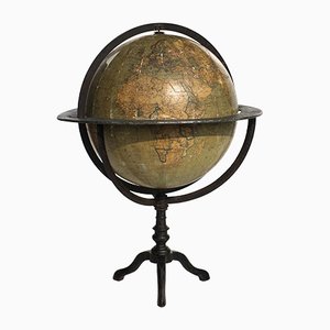
Antique Italian Terrestial Globe by Guido Cora, 1900s
Trending