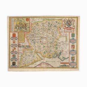
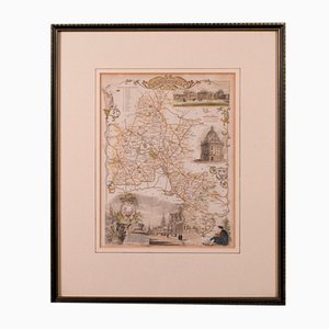
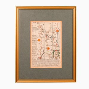
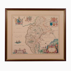
Issue of John Speeds Map of Hampshire
$1,907
You are now following Wall Decor. You can manage alerts in your account settings.
You have unfollowed Wall Decor.
Issue of John Speeds Map of Hampshire
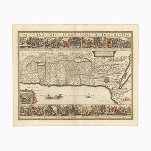
17th Century Panelled Map of the Holy Land
Incunable Map of Arabia with Lapis Lazuli Blue
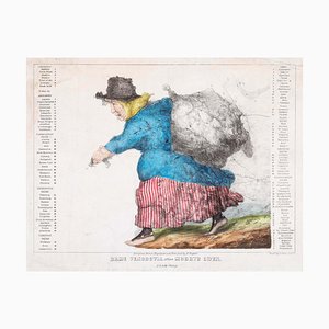
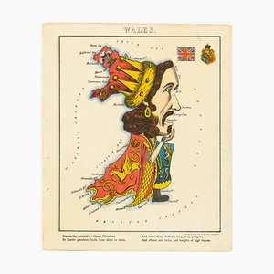
Caricature Map of Wales
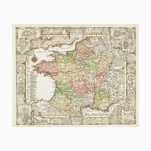
Map of France Celebrating the Military Successes of Louis XIV
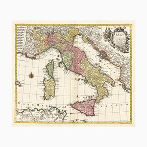
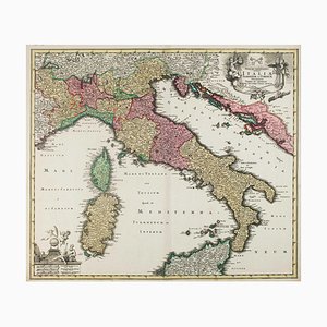
18th Century Map of Italy in Bright Colour
Decorative Map of Malta Celebrating the Knights by Enzo Mari
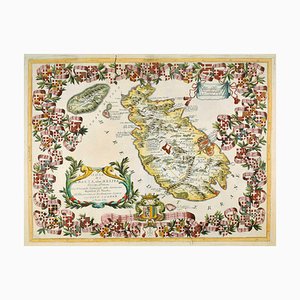
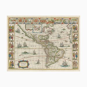
Figure Map of America
18th Century Map of Italy in Fine Colour
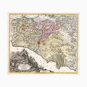
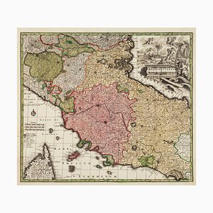
18th Century Map of the Papal States
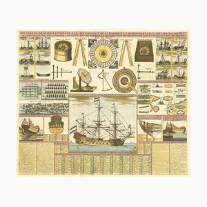
18th Century Maritime Explanatory Print
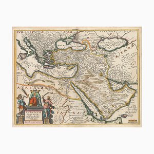
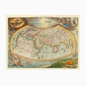
17th Century Map of the Turkish Empire
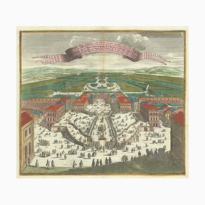
Birds-Eye View of Louis XIV Court at Versailles
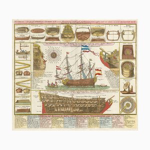
Early 18th Century Warship Chart
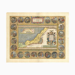
The Peregrinations of Abraham, 1603
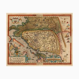
Orteliuss Landmark Map of China
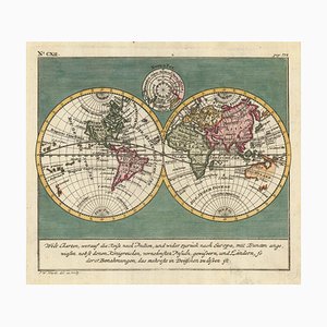
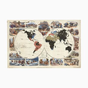
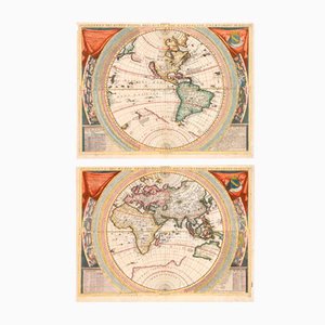
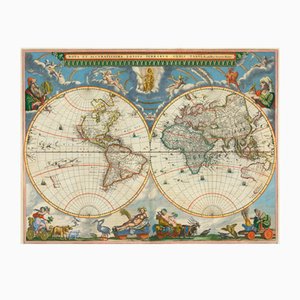
18th Century Double-Hemisphere World Map
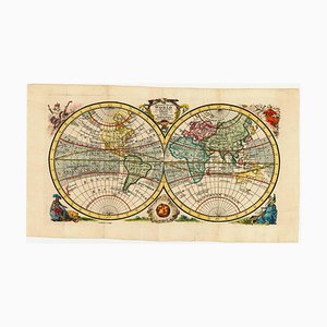
English Double-Hemisphere World Map Showing Discoveries
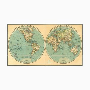
Late 19th Century Double-Hemisphere World Map in Cyrillic
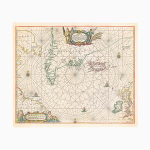
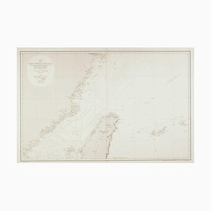
17th Century Dutch Sea Chart of the North Atlantic
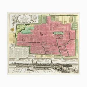
18th Century Town Plan of the Hague
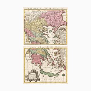
18th Century Two-Sheet Map of Ancient Greece from Aeg
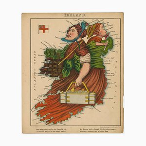
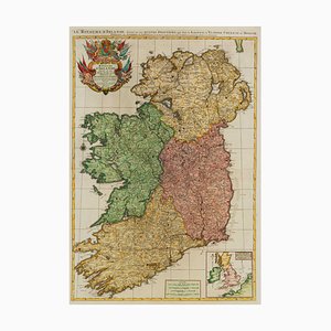
Satirical Map of Ireland
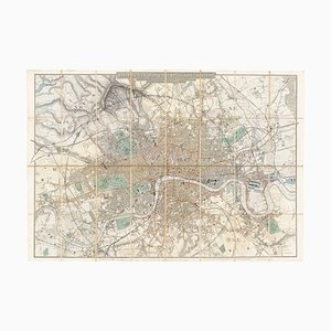
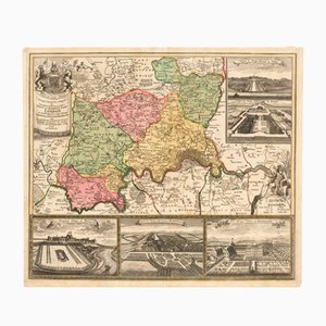
Map of the Environs of London in Fine Colour
Pictorial Map of Wales
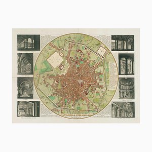
Map of Milan with Vignettes of Interiors
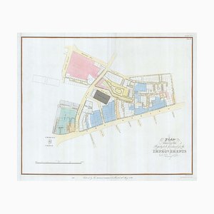
Nashs Plan to Redevelop Charing Cross
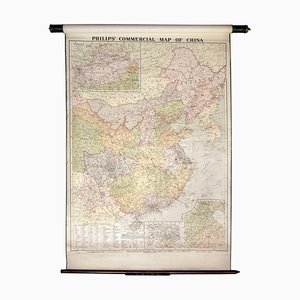
Wall Map Illustrating the Commerce of China
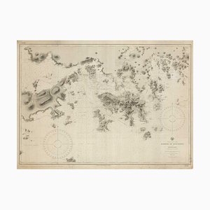
9th Century American Sea Chart of Hong Kong
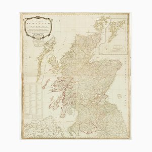
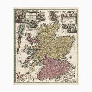
Wall Map of Scotland
19th Century Spanish Sea Chart of China with Taiwan
Two-Sheet Map of Ireland
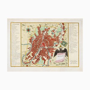
Town Plan of Moscow in the 18th Century
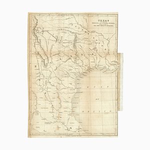
Map of the Republic of Texas
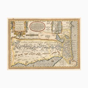
16th Century Map of Ancient Egypt from Aeg, 1601
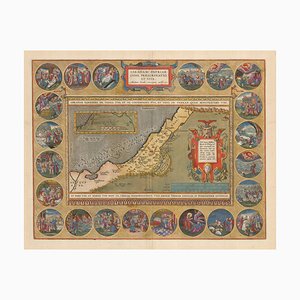
16th Century Map of the Peregrinations of Abraham, 1603
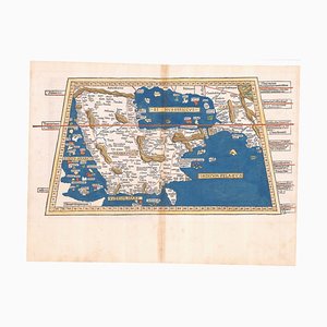
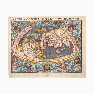
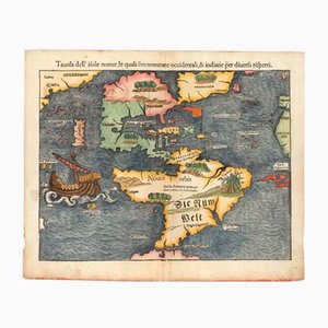
16th Century Woodcut Map of the World According to Ptolemy
The First Plate of Orteliuss Classic World Map, 1584
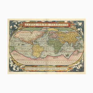
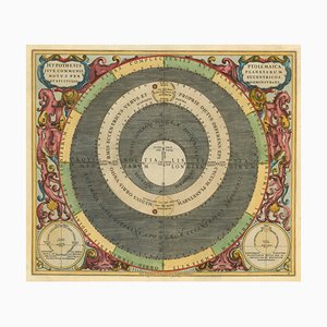
Chart of the Copernican Solar System, 1700s

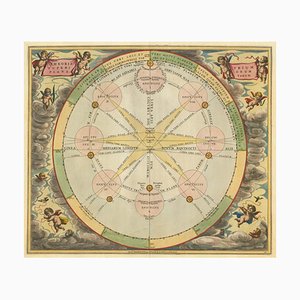
Chart of the Apparent Motions of Mars, Jupiter & Saturn
17th Century Celestial Chart Showing the Ptolemaic Planetary Orbits
Pictorial Map of the World Promoting Protestant Missionary Work
18th Century Map of Tuscany and the Papal States
18th Century Map of Scotland
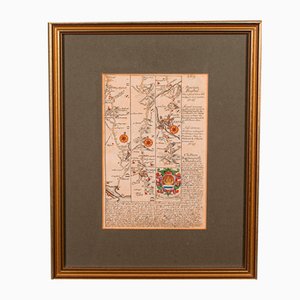
Antique Lithography Map, Shropshire, English, Framed, Cartography, Victorian
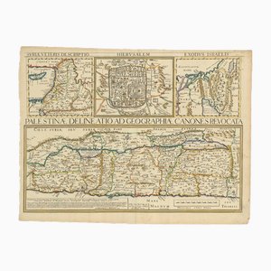
17th Century Map of the Holy Land Palestine, 1641
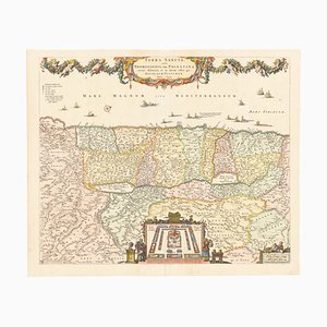
17th Century Map of the Holy Land Terra Sancta
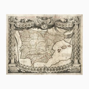
Antique Map of Spain Triumphant Under the Reign of Philip V by Nicolas De Fer, 1704
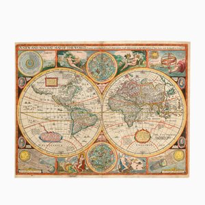
Antique Map of the World after J. Speed, 1651
Antique 17th Century World Maps in the style of Coronelli, Set of 2
Antique Map of London by Gabriel Gualdo Priorato, 1675
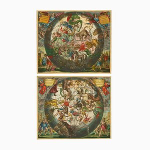
Antique Celestial Hemispheres Charts by Andreas Cellarius for Schenk & Valk, 1708, Set of 2
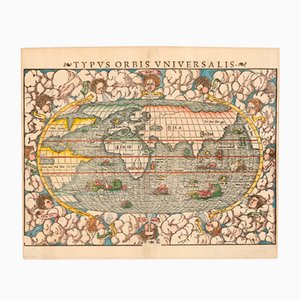
Typus Orbis Universalis Map by Sebastian Munster, 1552
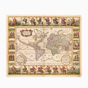
Antique Nova Totius Terrarum Orbis Geographica ac Hydrographica Tabula Claes Map by Janszoon Visscher, 1652
Map of the Environs of London with Inset Views of Royal Palaces by Johann Baptist Homann, 1710
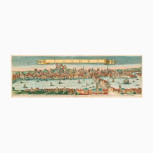
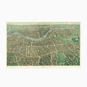
Antique Balloon View of London Map As Seen from Hampstead by John Henry Banks for Banks & Co. & Effingham Wilson, 1851
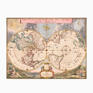
Antique Double Hemisphere Map of the World on a Polar Projection by J. Blaeu, 1695
Antique Map of the Ptolemaic World by Gerard Mercator, 1700
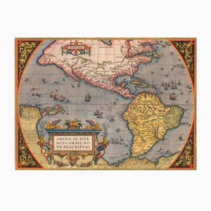
Antique America Sive Novi Orbis Nova Descriptio Map by Abraham Ortelius, 1598
Antique Nova et Accuratissima Totius Terrarum Orbis Tabula Map by Johannes Blaeu, 1662
Antique First Map of the Continent of America by Sebastian Munster, 1558
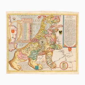
Antique Ecce, Quibus Hispaniar. Rex Philipp. Belgium (The First Leo Belgicus) Map by Michael Eytzinger, 1587
Antique English Framed Nottinghamshire Map
Antique English Victorian County Map
Antique English Framed Leicestershire Map
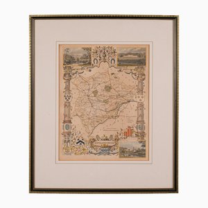
19th Century English Oxfordshire Country Map
Antique English Rutlandshire County Map, 1860s
Antique English Framed County Map
Martinique, Original Early Map: Representation la plus nouvelle et exacte De L'Ile Martinique, la premiere des Iles Del' Amerique Antilles...,1741, Original Hand Colored Copperplate Engraving
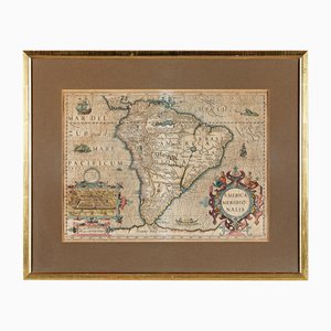
America Meridionalis, Early Map of South America by Gerard Mercator and Jodocus Hondius, 1610, Original Hand Colored Copperplate Engraving
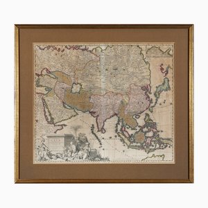
Early Map of Asia: Exactissima Asiae Delineatio in Praecipuas Regiones Original Hand Colored Copperplate Engraving by Carel Allard, 1694
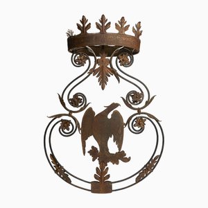
Antique Wrought Iron Sign with Eagle, 18th Century
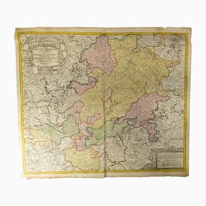
18th Century Hand Colored Engraved Map of Germany S.R.I Circulus Rhenanus
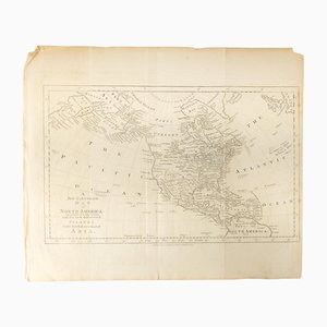
18th Century Map of North America, United States, and Asia by Bowen Thomas and Charles Cooke
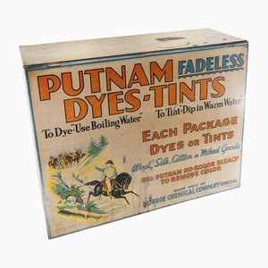
19th Century Countertop Advertising Display for Putnam Dyes-Tints
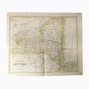
Antique Hand Colored Map of New York State from 1842
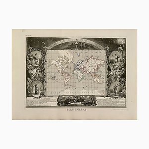
Planisphere World Map, 1849
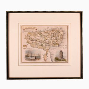
Antique English Isle of Thanet Lithography Map
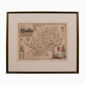
Antique Framed Lithographic Map of Hertfordshire, England
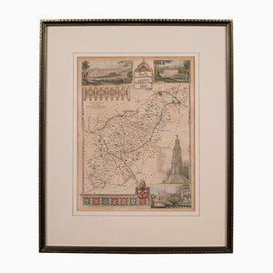
Antique Framed Lithographic Map of Northamptonshire, England, 1860
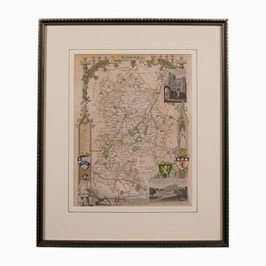
Antique Framed Lithographic Map of Bedfordshire, England
Antique Geographical Maps of the French-German War, Set of 4

Antique English Chart of Devon
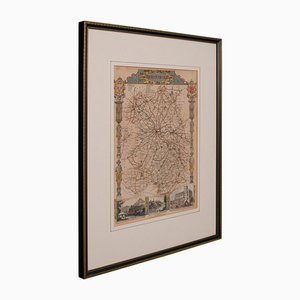
Antique English Coaching Road Map
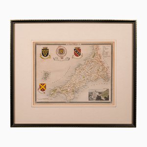
Antique English Lithography Map of Cornwall, 1850s
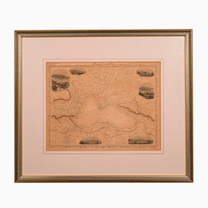
Antique English Lithography Map of Black Sea
Antique English Lithography Map
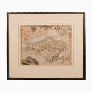
Antique English Lithography Map of Isle of Wight
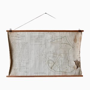
French N°2 Cadastral Plan, 1933
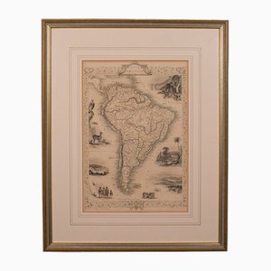
Antique English Lithography Map of South America
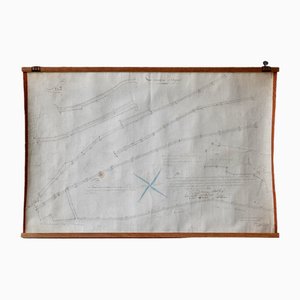
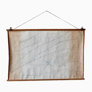
Plan d'Etupes N°3 Chart, 1833
French Plan of 1788, 1825
Japanese Wooden Kanban Restaurant Sign

Antique Levasseur La Marne & Cote d'Or Wine Maps, 1852, Set of 2
Old Map of Etupes, 1833
Early Enamel London Transport Bus Stop Sign with Provenance, 1940s

Trending