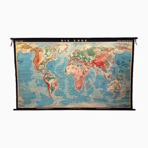
Large World Globe Map in Hand Carved and Inlaid Wood
$3,097

You are now following Charts. You can manage alerts in your account settings.
You have unfollowed Charts.
Large World Globe Map in Hand Carved and Inlaid Wood
Vintage School Poster Larynx, 1940s

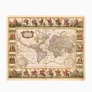
Antique Nova Totius Terrarum Orbis Geographica ac Hydrographica Tabula Claes Map by Janszoon Visscher, 1652
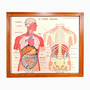
Vintage Double Sided School Posters in Frame of the Human Body, 1950s
Vintage School Chart, 1930s

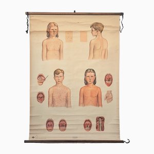
Vintage Training Poster with Childhood Illnesses, 1930-1940
Vintage School Poster, 1930s

Large Relief Map of the World by George Philip
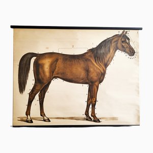
Mid-Century Lithographic Horse Wall Chart, 1960s
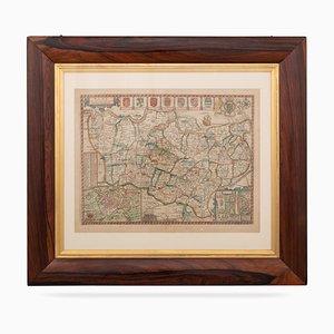
Dutch County Map Buckinghamshire - Bedfordshire by Janssonius

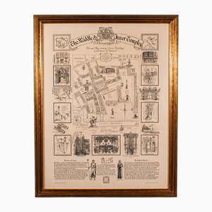
Vintage English Barristers Map of London, 1970s
Colourful Map of the History of London, 1970s

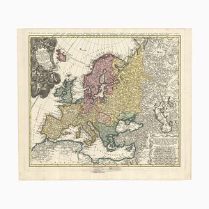
Mid-18th Century Map of Europe Showing the Spread of Religions
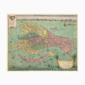
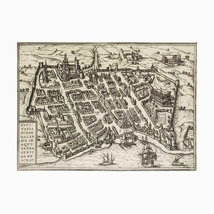
Early 18th Century Map of Venice
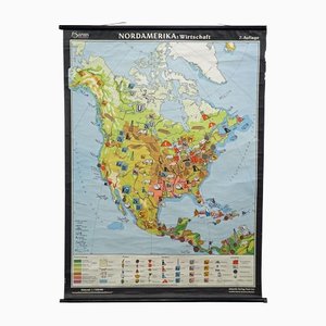
Vintage North America Economy Map, 1970s
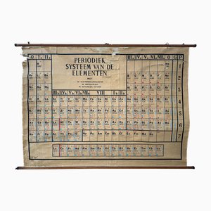
Large Vintage Linen Card Periodic Table of Elements
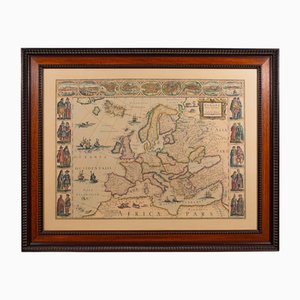
Vintage Reproduction of 17th Century Map of Europe, 1970s
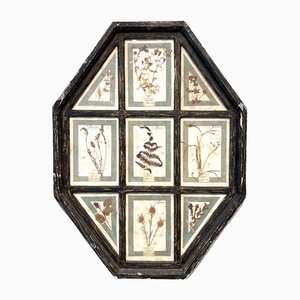
Vintage Herbarium in Glazed Wooden Frames, Florence, 1941
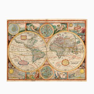
Antique Map of the World after J. Speed, 1651
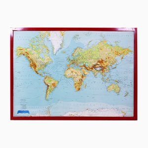
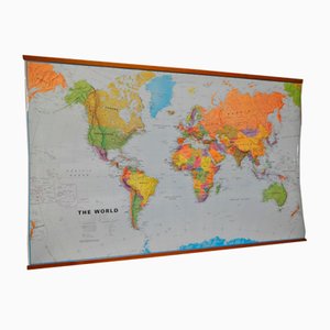
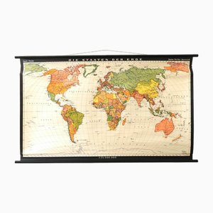
World Map in Laminated Paper
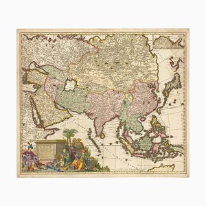
17th Century Map of Asia, 1690
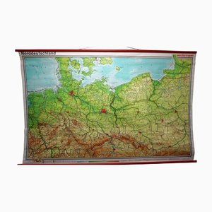
Vintage Northern Germany Poland Seaside Baltic Sea Rollable Map Wall Chart
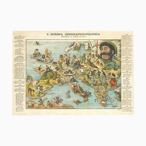
Italian Serio-Comic Map of Europe, 1871
Map of Ancient Rome in the style of Ligorio, 1657

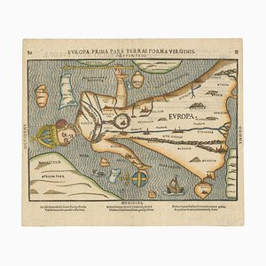
Antique Map of the Ptolemaic World by Gerard Mercator, 1700
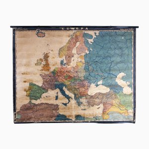
Large Early 20th Century School Wall Map Europe by Dr. Haack for Perthes, Gotha, 1890s
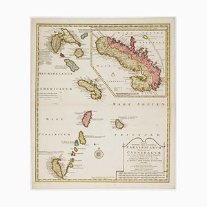
Early 18th Century Map of the Caribbean
The Famous Sea-Monsters Map of Iceland, 1595

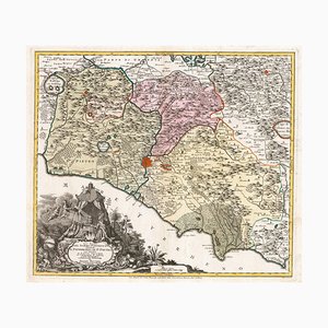
18th Century Map of the Papal States
Map of Europe as a Queen from Buntings Itinerarium
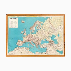
Modern Italian Topographic Geographical Map in Wood Frame of Europe, 1950s-1990s
Vintage School Board "Muscle of Man", Germany, 1950s
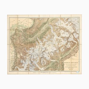
Map of the Mont Blanc Massif
Italian Serio-Comic Map of Europe During the Great War, 1890s

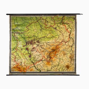
Large Vintage German Linen School Map of Central Europe, 1960s
Vintage School/Teaching Card Latin Source Script from Röhr Verlag, 1940s

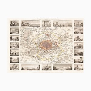
Paris and Surrounding Areas Map, Mid 19th Century
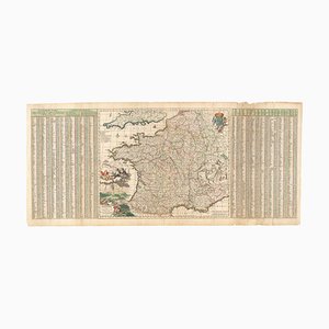
17th Century Map of France with Gazzetteer Side-Panels
World Pull-Down School Map by Hermann Haack, 1970s
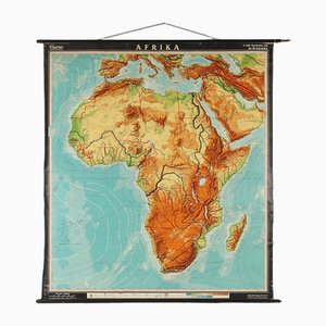
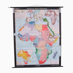
Large Africa School Map, 1950s
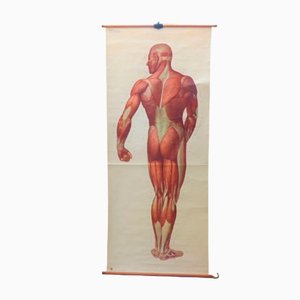
Antique Human Skeleton Anatomical Wall Chart

Pictorial Map of South Africa from the Second World War, 1940s

Large Vintage Colourful Europe School Map, 1960s
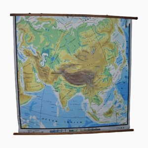
Physical Map of Asia, 1960s
Vintage School Europe Wall Map by Leisering & Schulze for Velhagen, 1950s

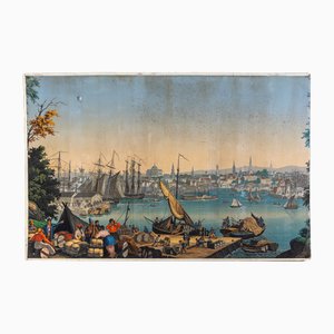
Boston Harbor from Views of North America from Zuber Et Cie, France
16th Century Map of Barcelona by Valegio, 1598

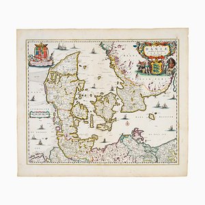
17th Century Map of Denmark
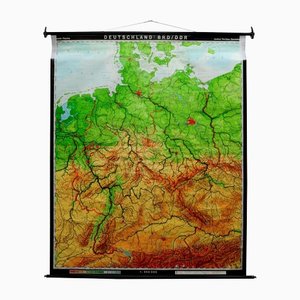
Vintage Germany BRD / DDR History Wall Chart Pull-Down Map
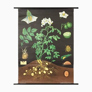
Vintage Botanical West German Biology Print Chart by Hagemann, Germany, 1960s
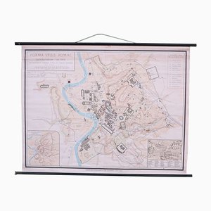
School Wall Map of Old Rome from Instituto Geografico de Agostini Nora, 1950s
Vintage Map of the World by John Speed, 1651

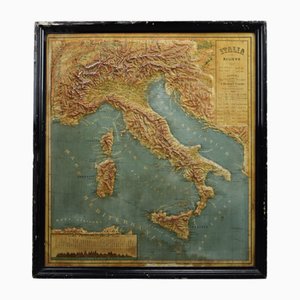
18th Century Map of Italy in Bright Colour

Map of the Environs of London in Fine Colour
18th Century Map of Tuscany and the Papal States

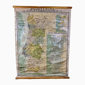
Chorographic Map of Portugal, 1942
Burdigala, Map from ''Civitates Orbis Terrarum'' - by F.Hogenberg - 1575 1575
School Wall Map of Africa by Leisering & Schulze for Velhagen & Klasing, 1950s
1889 Map of Italy, 1899
Vintage School/Teaching Card the States of the Earth by Haack-Painke for Justus Perthes Publisher, 1960s
Mid-19th Century Plan of Constantinople by Sduk, 1840s

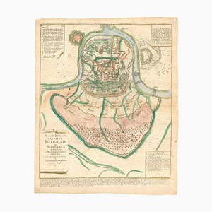
Plan of the Ottoman Siege of Belgrade, 1739
Map of the Persian Gulf

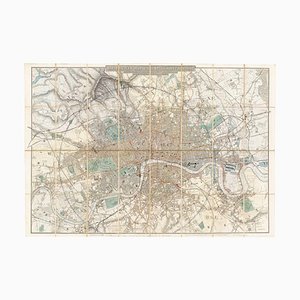
Detailed Map of London During the Great Exhibition of 1851

18th Century Map of Italy in Fine Colour

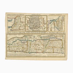
17th Century Map of the Holy Land Palestine, 1641
Large Scrolled Map of the World by Philips, 1918
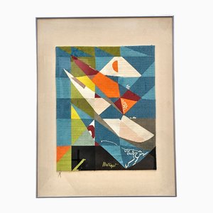
Key Largo Tapestry in Limited Edition by Mathieu Matégot
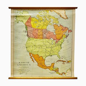
Large University Chart Political Map of North America by Bacon, 1920s
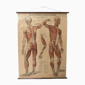
Vintage Swedish Anatomical Medical Wall Hanging
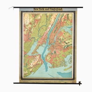
Antique New York Map from Westermann, 1920s
School Wall Map of the Human Body by Prof. Dr. med. W. Blotevogel for Hagemann Düsseldorf, 1950s

Mid-17th Century Map of the Far East

18th Century Town Map of Peking

Charts of Physical Maps from North Rhine Westphalia NRW
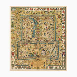
Pictorial Map of Beijing by Frank Dorn, 1936
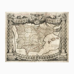
Antique Map of Spain Triumphant Under the Reign of Philip V by Nicolas De Fer, 1704
Vintage Mural Map Mediterranean Sea Near East Countries Rollable Wall Chart, 1970s

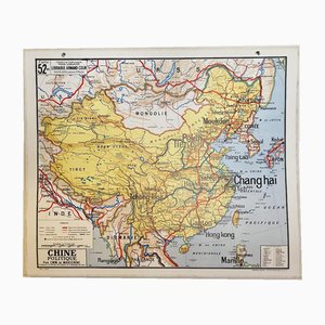
Map of China, 1960s
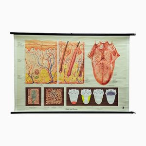
Vintage Human Skin Tongue Rollable Medical Wall Chart Poster
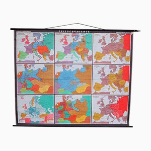
Large School Teaching Map on Contemporary History from Flemming Verlag Hamburg, 1950s
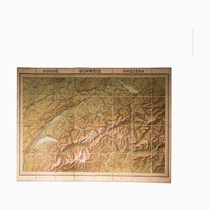
Vintage Geographical Map of Switzerland, 1930s
World Map of Elwe, 1792

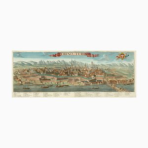
Prospect of Turin Map
A Prospect of the Great Fire of London, 1600s
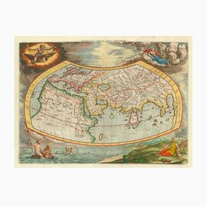
Fantasy Map of Asia as Pegasus

Prospect of Medieval London Bridge Covered with Houses

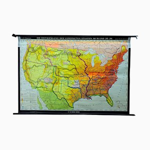
Vintage United States Mural Map, 1979
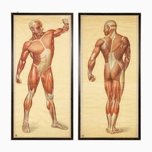
Anatomical Human Muscular Structure Charts by Tanck & Wagelin, 1950, Set of 2
17th Century Map of Kent with Her Cities & Earles Described by John Speed, 1670s
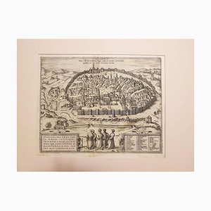
Jerusalem, Antique Map from ''Civitates Orbis Terrarum'' - 1572-1617 1572-1617
Vintage Portugal School Map, 1940s
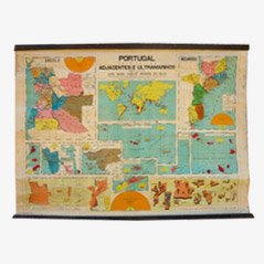
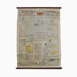
Map of Portugal and Overseas, 1960s
Vintage Eye Doctors Illuminated Eye Test Chart, Germany, 1960s

Roman Mythology Framed Engravings, 18th Century, Set of 2

Vintage Linen School Map In the Brazilian Jungle

Trending