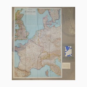
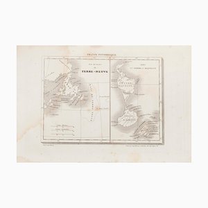
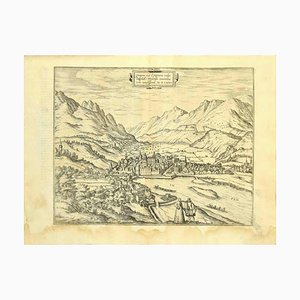
Opera Cartographic Mirabile Card from North Sea to the Mediterranean and Ethnographic Europe from C. T. I. Milan, Italy, 1939, Set of 3
$409
You are now following Charts. You can manage alerts in your account settings.
You have unfollowed Charts.
Opera Cartographic Mirabile Card from North Sea to the Mediterranean and Ethnographic Europe from C. T. I. Milan, Italy, 1939, Set of 3
Anatomical Chart from the German Hygiene Museum, Dresden, Germany, 1950s

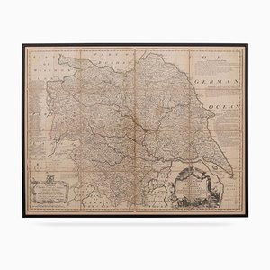
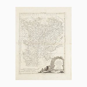
18th Century Map of the County of York by Emanuel Bowen, 1740s
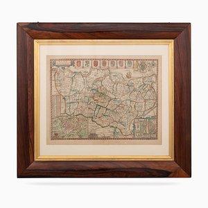
17th Century Map of Kent with Her Cities & Earles Described by John Speed, 1670s
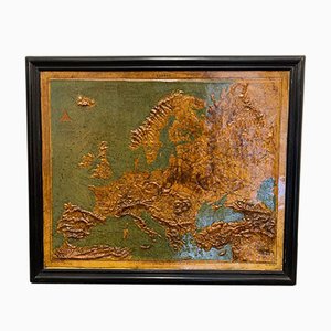
Relief Map of Europe by F. Dufour
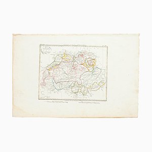
Map of Switzerland, Original Etching, 19th Century
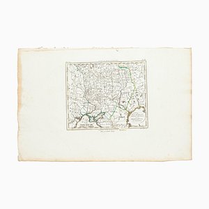
Marco Di Pietro, Map, Original Etching, 19th Century
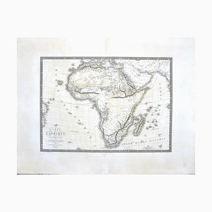
Map of Africa by C. Brue, 1820
Map of Paris, Original Etching, 19th Century

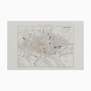
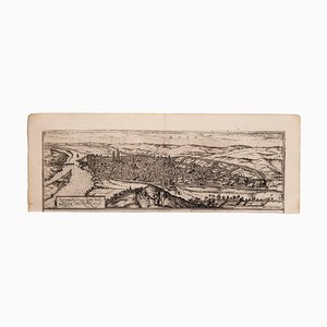
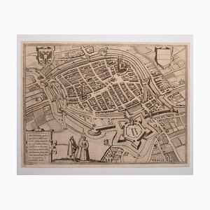
Unknown, Map of Rouen, Original Etching, 19th Century
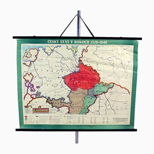
Vintage School Map of Czech State, Czechoslovakia, 1960s
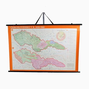
Vintage School Map of Czechoslovakia in 1939 1945, 1960s
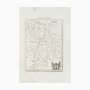
Unknown, Map of Vienne, Etching, 19th Century
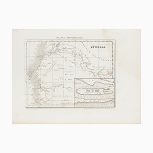
Unknown, Ancient Map of Senegal, Etching, 19th Century
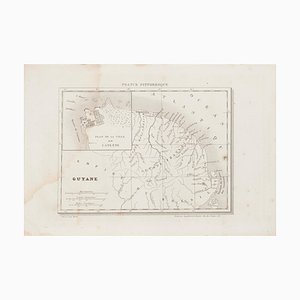
Unknown, Ancient Map of Guyane, Etching, 19th Century
Franz Hogenberg - Map of Meissen - Original Etching - Late 16th Century
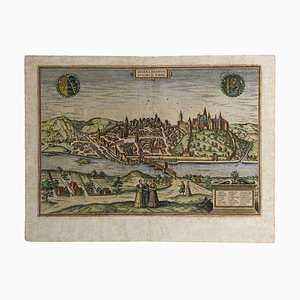
Franz Hogenberg, Map of Rouen, Etching by G.Braun and F. Hogenberg, Late 16th Century
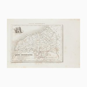
Unknown - Price - Map of Seine - Original Etching - 19th Century
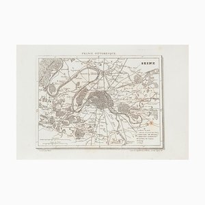
Map of Seine - Etching - 19th-Century
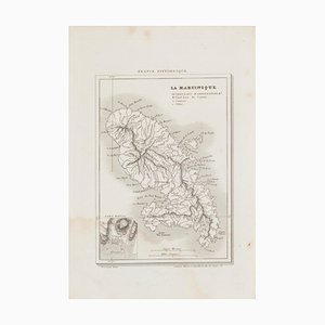
Map of Martinique - Etching - 19th-Century
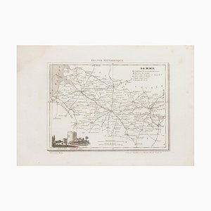
Unknown, Map of Somme, Etching, 19th Century
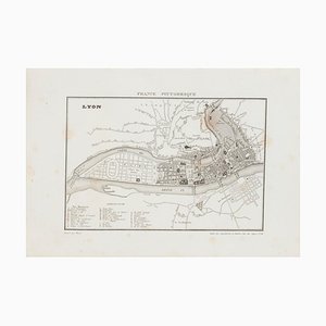
Unknown, Map of Lyon, Etching, 19th Century
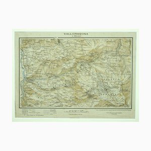
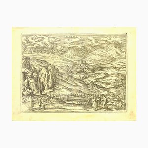
Unknown - Map of Vallombrosa - Florence 1926
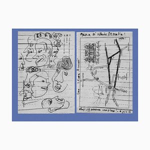
Alberto Moravia, Ticket Map, Letters With Sketches, 1956
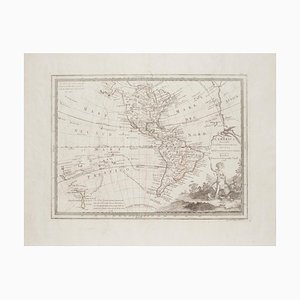
Unknown - The Americas - Vintage Map - 18th century
Unknown, Map of Seine, Etching, 19th Century

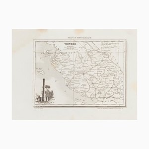
Unknown - Map of Vendée - Original Etching - 19th Century
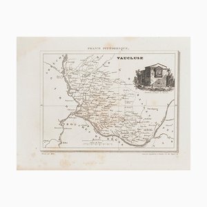
Unknown - Map of Vaucluse - Original Etching - 19th Century
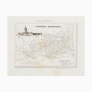
Unknown, Map of Pyrénées, Etching, 19th Century
Antonio Zatta, Map of Greece, Etching, 18th Century
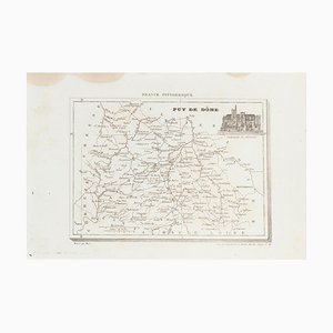
Unknown - Map of Puy De Dome - Original Etching - 19th Century
Unknown - Map of Terre Neuve - Original Etching - 19th Century
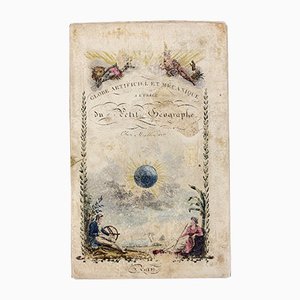
Instructions Globe Booklet from Augustin Legrand, 1830
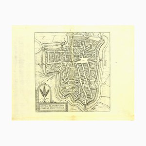
George Braun - Map of Groningen - Original Etching - Late 16th Century
Franz Hogenberg - Map of Alhama - Etching - Late 16th Century
Franz Hogenberg - Map of Innsbruck - Etching - Late 16th Century
Franz Hogenberg - Map of Embden - Original Etching - Late 16th Century
Franz Hogenberg - Price - Map of Kalkar - Etching - Late 16th Century
Franz Hogenberg - Map of Magdeburg - Etching - Late 16th Century
Franz Hogenberg - Map of Ypres - Etching - Late 16th Century
Franz Hogenberg - Map of Augsburg - Etching - Late 16th Century
Franz Hogenberg - Map of Nijmegen - Etching - Late 16th Century
Franz Hogenberg - View of Kempten in Allgau - Etching - Late 1500
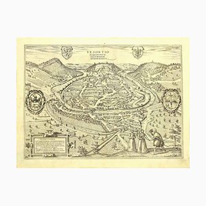
Franz Hogenberg - View of Vesontio - Etching - Late 16th Century
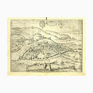
Franz Hogenberg - View of Namur (belgium) - Etching - Late 1500
Franz Hogenberg - View of Gorlitz - Etching - Late 16th Century

Franz Hogenberg - Brielle Den Briel - Etching - Late 16th Century
Unknown - Map - Original Etching - Late 19th Century
Unknown - Map of Persia - Original Etching - Late 19th Century

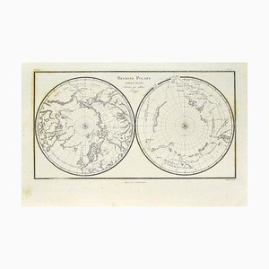
Unknown - Map of Polar Regions - Original Etching - Late 19th Century
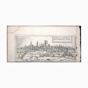
Munchen, Antique Map from ''Civitates Orbis Terrarum'' - 1572-1617 1572-1617
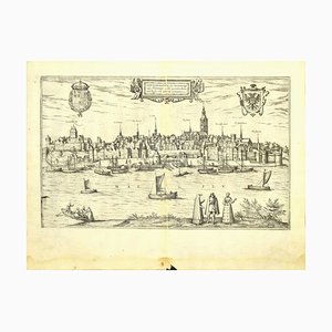
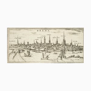
Bremen, Map from ''Civitates Orbis Terrarum'' - by F.Hogenberg - 1572-1617 1572-1617
Old British Empire Map - Ancient Map by Karl Spruner - 1760 ca. 1760 ca.
Moscow /Moscovia Antique Map, Civitates Orbis Terrarum by Braun and Hogenberg 1572-1617
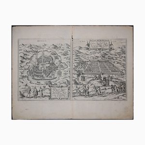
Mexico City & Cusco Antique Map, Civitates Orbis Terrarum by Braun & Hogenberg 1572-1617
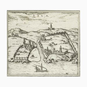
Sala, Map from ''Civitates Orbis Terrarum'' - by F.Hogenberg - 1575 1575
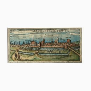
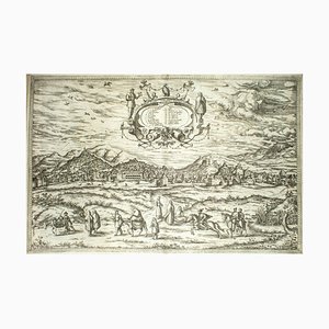
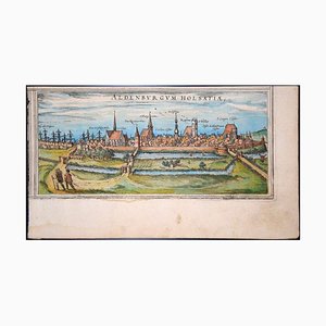
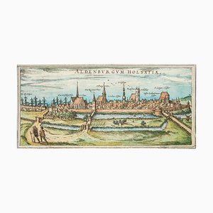
Map of Aldenburgum Holsatie - From ''Civitates Orbium Terrarum'' - 1575 1575
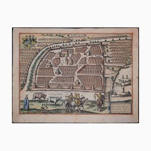
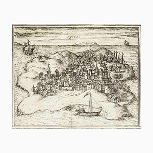
Quiloa, Map from ''Civitates Orbis Terrarum'' - by F.Hogenberg - 1575 1575
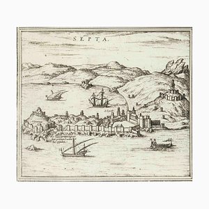
Septa, Map from ''Civitates Orbis Terrarum'' - by F.Hogenberg - 1575 1575
Modon, Map from ''Civitates Orbis Terrarum'' - by F. Hogenberg - 1575 1575
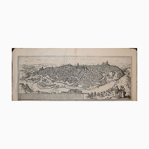
Ypra, Map from ''Civitates Orbis Terrarum'' - by F. Hogenberg - 1575 1575
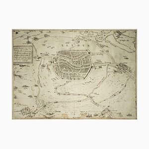
Leyden, Map from ''Civitates Orbis Terrarum'' - by F. Hogenberg - 1575 1575
Nuremberg, Map from ''Civitates Orbis Terrarum'' - by F. Hogenberg - 1575 1575
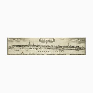
Bonn, Map from ''Civitates Orbis Terrarum'' - by F. Hogenberg - 1575 1575
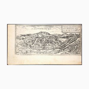
Salzburg, Map from ''Civitates Orbis Terrarum''-by F. Hogenberg - 1575 1575
Tangiaria (Tanger), Map from ''Civitates Orbis Terrarum''-by F. Hogenberg - 1575 1575

Dunkirk, Map from ''Civitates Orbis Terrarum'' - by F. Hogenberg - 1572/1617 1572/1617
Cascale, Map from ''Civitates Orbis Terrarum'' - by F. Hogenberg - 1575 1575
Aden, Map from ''Civitates Orbis Terrarum'' - by F. Hogenberg - 1575 1575
Heraklion, Map from ''Civitates Orbis Terrarum'' - by F. Hogenberg - 1575 1575
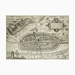
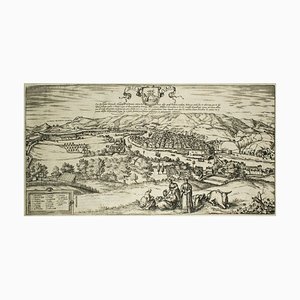
Map of Calcaria - From ''Civitates Orbium Terrarum'' by F. Hogenberg - 1575 1575
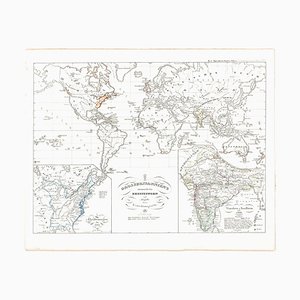
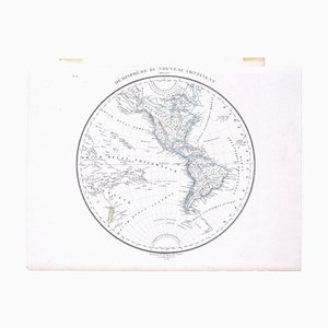
Hemisphere Of The New Continent - Ancient Map by J.G. Heck - 1834. 1834
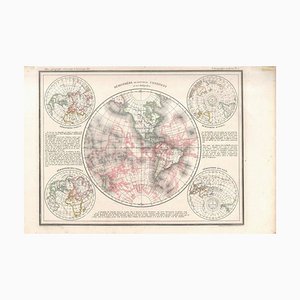
Hemisphere Of The New Continent - Ancient Map by J.G. Heck - 1834. 1834
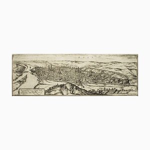
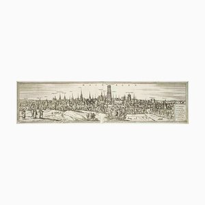
Rotomagus, Map from ''Civitates Orbis Terrarum'' - by F. Hogenberg - 1572/1617 1572/1617
Machelen, Map from ''Civitates Orbis Terrarum'' - by F. Hogenberg - 1575 1575
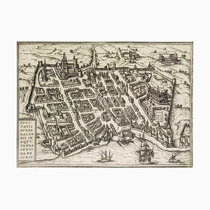
Burdigala, Map from ''Civitates Orbis Terrarum'' - by F.Hogenberg - 1575 1575
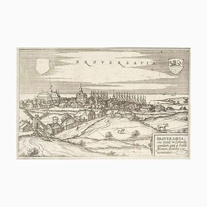
Broversavia, Map from ''Civitates Orbis Terrarum'' - by F.Hogenberg - 1575 1575
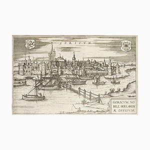
Goricum, Map from ''Civitates Orbis Terrarum'' - by F.Hogenberg - 1575 1575
Limbourg, Antique Map from ''Civitates Orbis Terrarum'' 1572-1617

Windsor, Antique Map from ''Civitates Orbis Terrarum'' 1572-1617
Danzig, Antique Map from ''Civitates Orbis Terrarum'' - 1572-1617 1572-1617
Utrecht, Antique Map from ''Civitates Orbis Terrarum'' 1572-1617
Corfu, Big Antique Map from ''Civitates Orbis Terrarum'' - 1572-1617 1572-1617
Bilbao, Antique Map from ''Civitates Orbis Terrarum'' - by F.Hogenberg - 1572-1617 1572-1617
Granada, Map from ''Civitates Orbis Terrarum'' - by F.Hogenberg - 1575 1575
Toledo, Map from ''Civitates Orbis Terrarum'' - by F. Hogenberg - 1575 1575
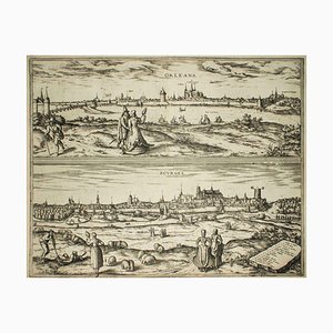
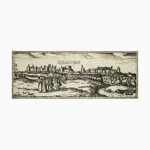
Orleans and Bourges, Map from ''Civitates Orbis Terrarum''-by F. Hogenberg - 1575 1575
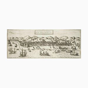
Kolkata (Calecut), Map from ''Civitates Orbis Terrarum'' - by F. Hogenberg - 1575 1575
Oxford, Map from ''Civitates Orbis Terrarum'' - by F. Hogenberg - 1575 1575
Stade, Antique Map from ''Civitates Orbis Terrarum'' - by F.Hogenberg - 1572-1617 1572-1617
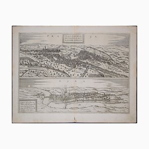
Prague and Egra, Antique Map from ''Civitates Orbis Terrarum'' 1572-1617
Stade, Antique Map from ''Civitates Orbis Terrarum'' - 1572-1617 1572-1617
Buda, Antique Map from ''Civitates Orbis Terrarum'' - 1572-1617 1572-1617
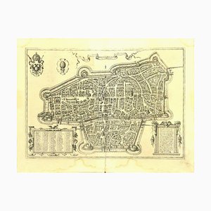
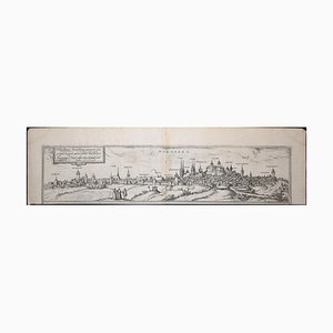
Nuremberg, Big Antique Map from ''Civitates Orbis Terrarum'' - 1572-1617 1572-1617

Little world map Rome Peking, Olympic Games Beijing 2008 2008
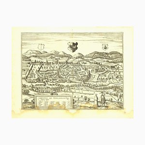
Li Governi di Borgogna - Original Ancient Map - 1777 1777
Trending