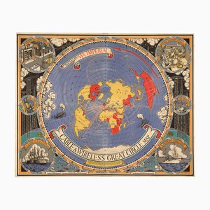
Great Circle World Map by Macdonald Gill
$21,747
You are now following Wall Decor. You can manage alerts in your account settings.
You have unfollowed Wall Decor.
Great Circle World Map by Macdonald Gill
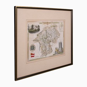
Victorian English Lithographic Map of Westmoreland
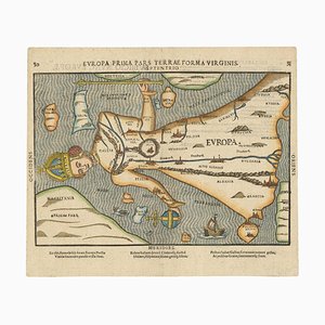
Map of Europe as a Queen from Buntings Itinerarium
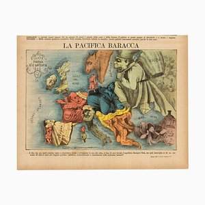
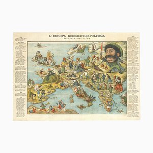
Italian Edition of Hadols Serio-Comic Map of Europe
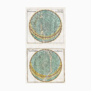
18th Century Celestial Charts of the Northern and Southern Skies, Set of 2
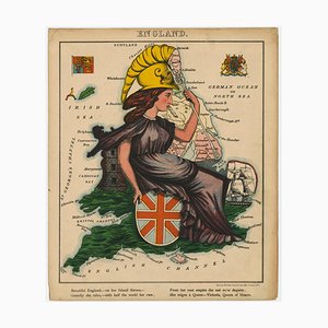
Allegorical Map of England
Caricature Map of Ireland

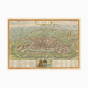
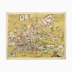
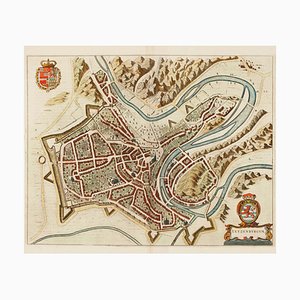
16th Century Plan of Rome
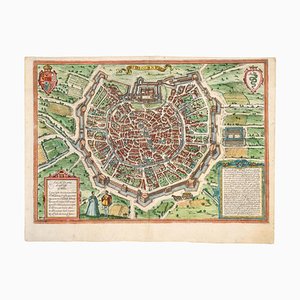
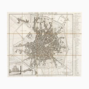
Early Town Plan of Milan
Rome's Pantheon, 1600s, Engraving

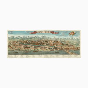
Prospect of Turin Map
19th Century Map of Milan (Italy) - Antonio Tua, 1840
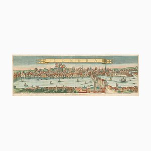
A Prospect of the Great Fire of London, 1600s
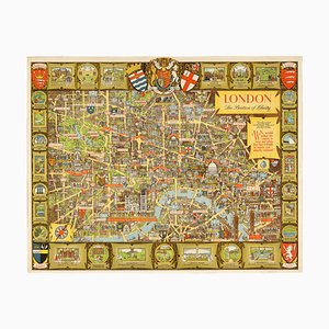
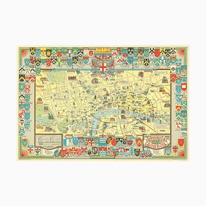
Post-War Pictorial Wall Map of London
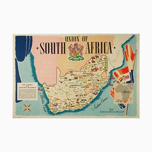
Pictorial Map of South Africa from the Second World War, 1940s
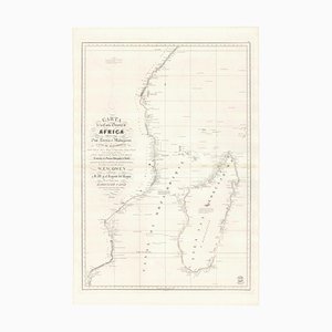
Spanish Sea Chart of Madagascar and Mozambique
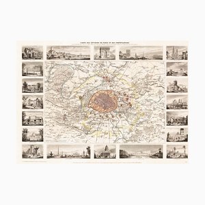
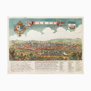
Paris and Surrounding Areas Map, Mid 19th Century
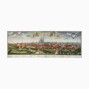
18th Century Prospect of Milan
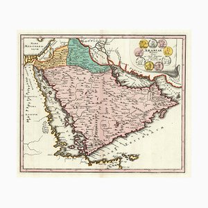
Map of Classical Arabia
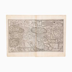
Map of the Middle East from Lafreri
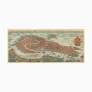
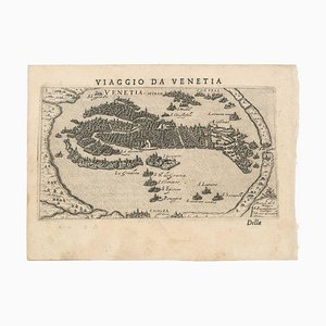
17th Century Prospect of Venice
Italian Serio-Comic Map of Europe, 1871
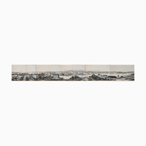
Panorama of Stockholm
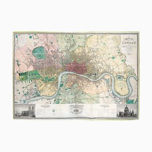
First Edition of Greenwoods Six-Sheet Plan of London
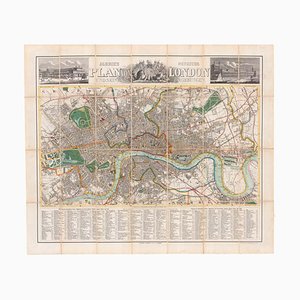
Tourists Plan of London for the Great Exhibition of 1851
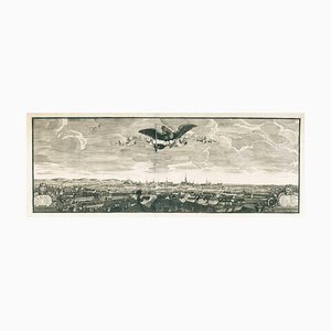
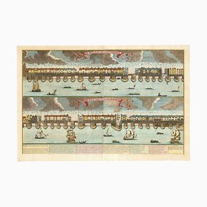
Panorama of Vienna Under Siege by the Ottomans
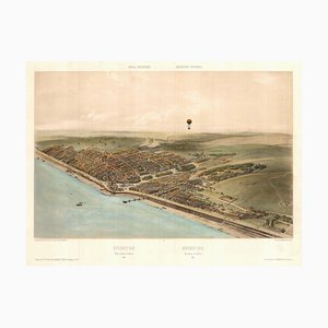
Unusual Balloon View of Brighton, 1840s
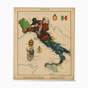
Caricature Map of Italy
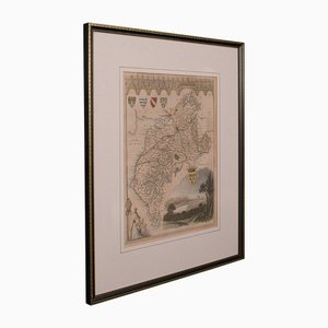
Victorian English Lithographic Map of Cumberland
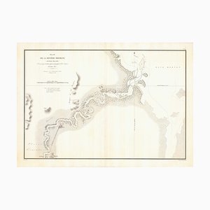
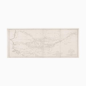
Early Chart of the Brisbane River
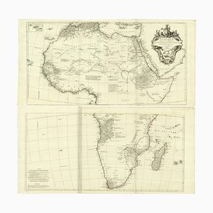
Venetian Edition of Danvilles Wall Map of Africa
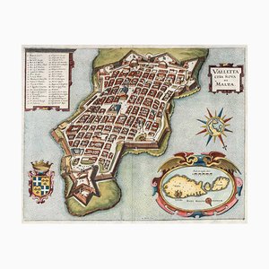
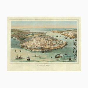
17th Century Plan of Valletta
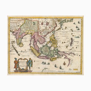
Mid-17th Century Map of the Far East
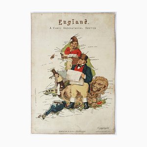
Caricature Map of England and Wales
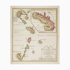
Early 18th Century Map of the Caribbean
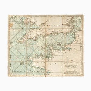
18th Century Sea Chart of the English Channel
The Route of the Spanish Armada Around the British Isles
First Issue of Rosaccios Map of Venice
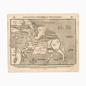
Fantasy Map of Asia as Pegasus
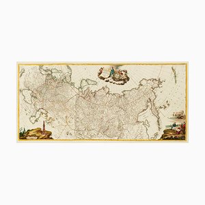
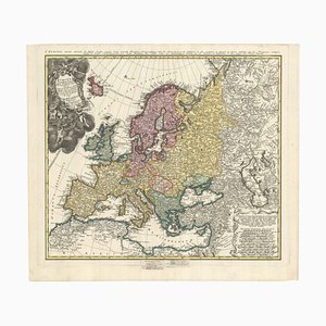
Three-Sheet Map of the Russian Empire
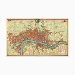
Printed Map of London
Colourful Map of the History of London, 1970s
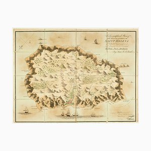
Napoleon in Exile on St Helena
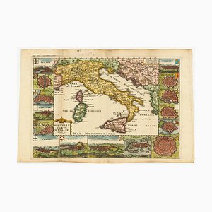
Map of Italy with Plans and Views of Cities
Pirate Edition of Morden & Leas Map of London
Map of Mungo Park's Search for the River Niger
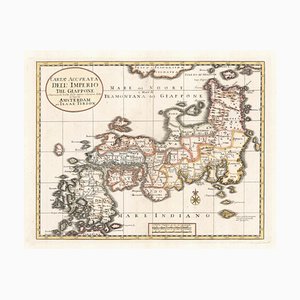
First State of the Tirion-Albrizzi Map of Japan
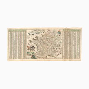
17th Century Map of France with Gazzetteer Side-Panels
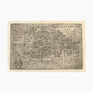
16th Century Italian Map of Cambridge
Upside-Down Birds-Eye View of Italy from the Alps
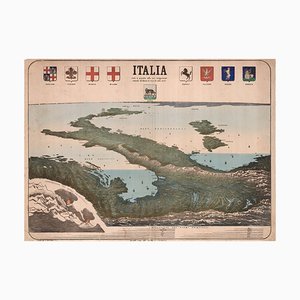
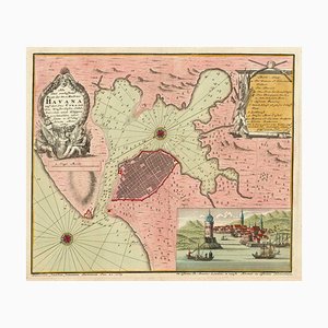
Chart of the Harbour of Havana
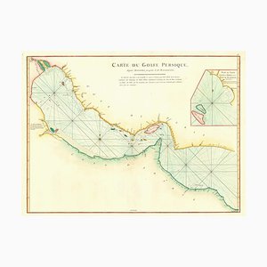
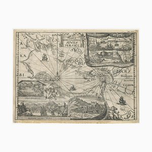
18th Century Map of the Persian Gulf
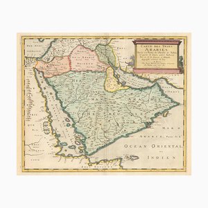
17th Century French Map of Arabia
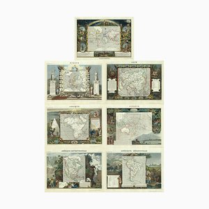
Maps of the World & Continents, Set of 7
A Scarce Birds-Eye View of Paris
Early Birds-Eye View of Havana
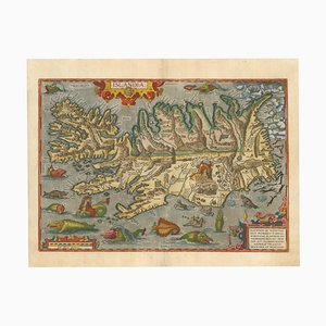
The Famous Sea-Monsters Map of Iceland, 1595
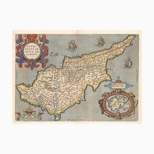
16th Century Dutch Map of Cyprus, 1598
Classic Carte-À-Figure Map of the Netherlands & Belgium
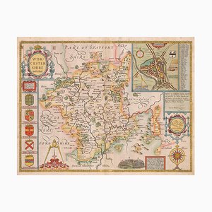
17th Century Map of Worcestershire, 1676
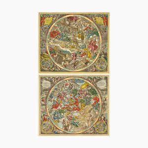
Celestial Charts with Christian Iconography, Set of 2
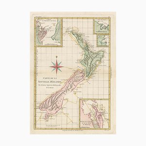
Map of New Zealand by Cook
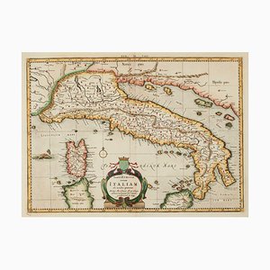
Ptolemaic Map of Italy
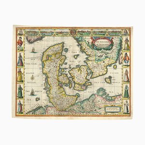
English Atlas Map of Denmark
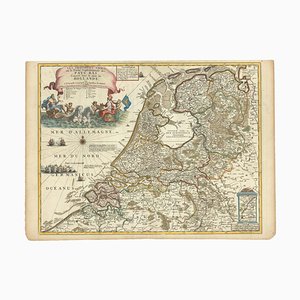
Map of the Netherlands with a Fine Maritime Cartouche by Enzo Mari
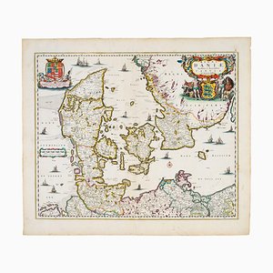
17th Century Map of Denmark
18th Century Map of Ukraine
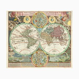
18th Century Double-Hemisphere World Map with Celestial Insets
18th Century Map of Corfu in Original Colour
18th Century Map Celebrating the Knights of Malta
Map of Ancient Rome in the style of Ligorio, 1657
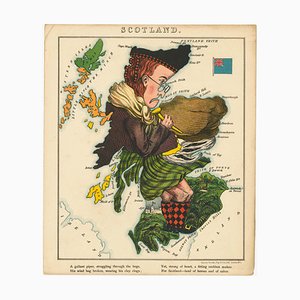
Satirical Map of Scotland
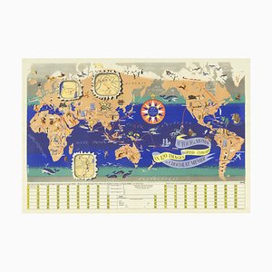
World Map as a Chocolatiers Competition, 1950s
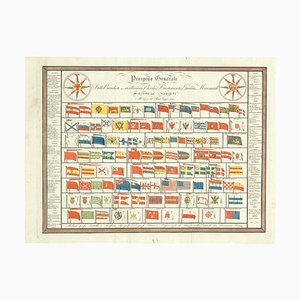
Early 19th Century Original Table of Maritime Flags
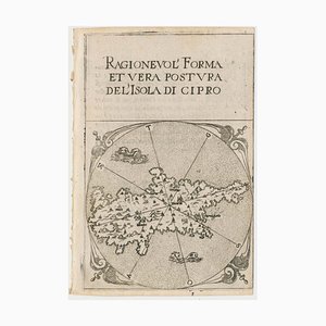
16th Century Miniature Map of Cyprus
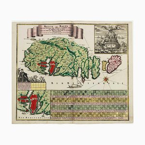
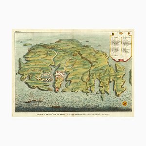
A Birds-Eye View-Map of Malta
Prospect of Medieval London Bridge Covered with Houses
Mid-18th Century Map of Europe Showing the Spread of Religions
17th Century Map of Luxembourg
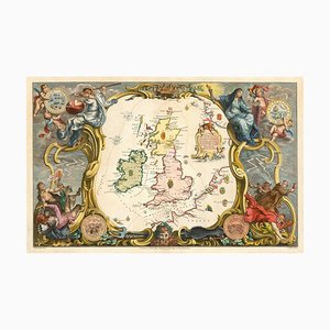
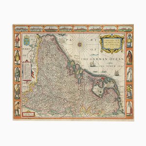
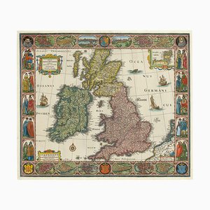
Map of the British Isles with Decorative Borders
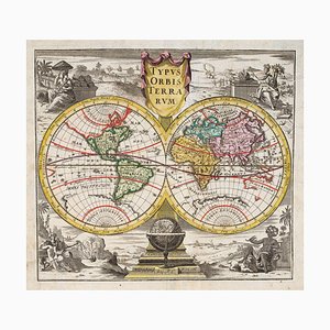
18th Century Double-Hemisphere World Map
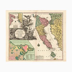
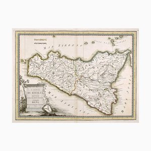
18th Century Map of Sicily
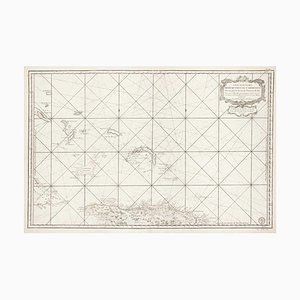
Large and Detailed Chart of the Bahamas, 1700s
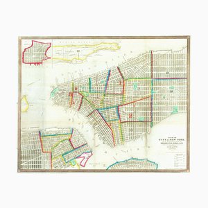
Mid-19th Century Town Plan of New York City
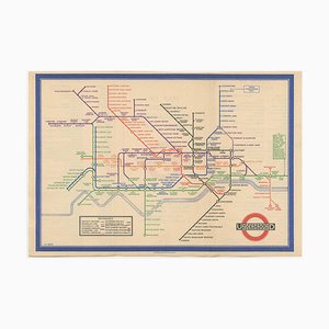
First Issue of Map of the London Underground, 1930s
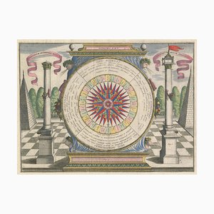
17th Century Wind Rose
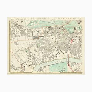
Detailed Map of Knightsbridge, Chelsea and Kensington
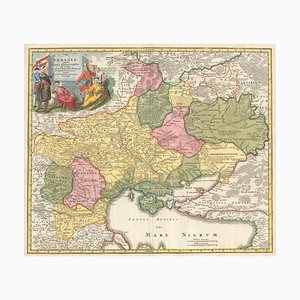
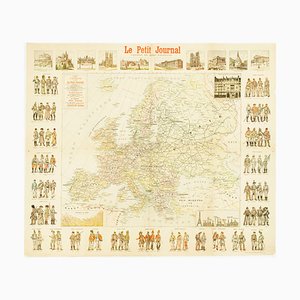
Wall Map of Europe Illustrated with Military Uniforms, 1890s
Early Prospect of Tokyo, 1700s
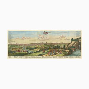
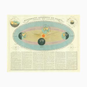
Diagram of the Seasons
Map of the Persian Gulf
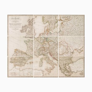
Wall Map of Europe According to the Congress of Vienna
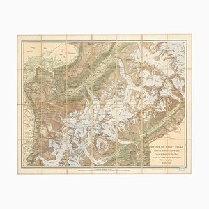
Map of the Mont Blanc Massif
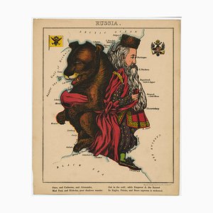
Pictorial Map of Russia
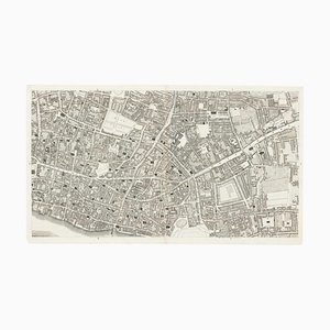
The City and Whitechapel from a Large-Scale Survey of London
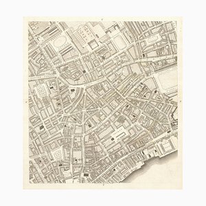
Covent Garden and Soho from a Large-Scale Survey of London
Trending