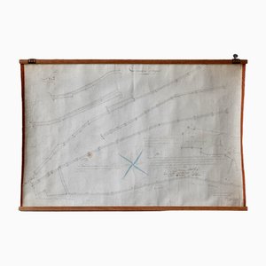
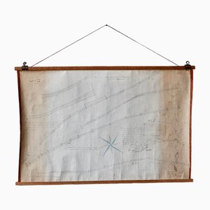
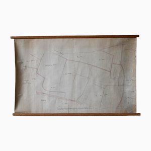
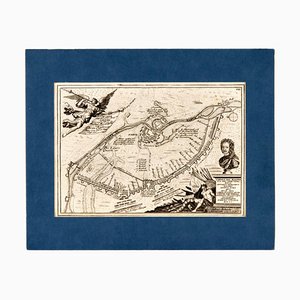
Small English Country Map, Northamptonshire, 1850s
$607

You are now following Charts. You can manage alerts in your account settings.
You have unfollowed Charts.
Small English Country Map, Northamptonshire, 1850s
Large English Wimbledon Map SW London

Antique English Framed Cambridgeshire County Map by Robert Morden, Late 17th Century

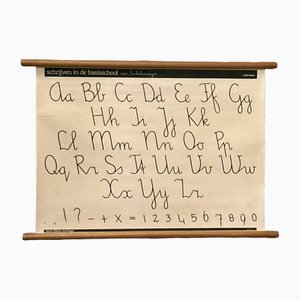
Vintage Pull-Down Wall Chart, 1970
Taiwan Map from Dutch East India Company, 1724

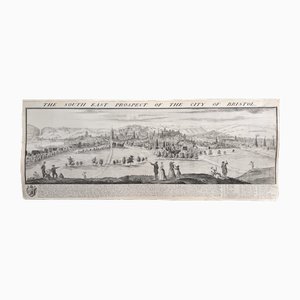
The South East Prospect of the City of Bristol by Samuel Buck, 1734
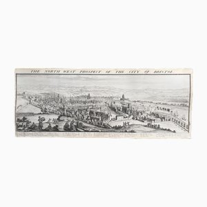
The North West Prospect of the City of Bristol by Samuel Buck, 1734
Large Antique Lithography Map of Kent, 1700

Vintage School/Teaching Card Latin Source Script from Röhr Verlag, 1940s

Large-Scale Survey of London Map with Marylebone & St Pancras

Large-Scale Survey of London Map with Knightsbridge

Prospect of Munich, Early 18th Century

16th Century Map of Barcelona by Valegio, 1598

Large-Scale Survey of London Map with St James's

Prospect of Bristol, 1600s

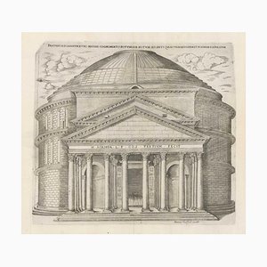
Rome's Pantheon, 1600s, Engraving
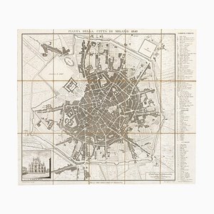
19th Century Map of Milan (Italy) - Antonio Tua, 1840
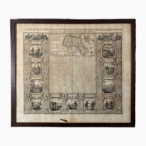
Spanish Sea Chart of Madagascar and Mozambique

The Great Seal of the Commonwealth, 1651

Panorama of Stockholm

Panorama of Vienna Under Siege by the Ottomans

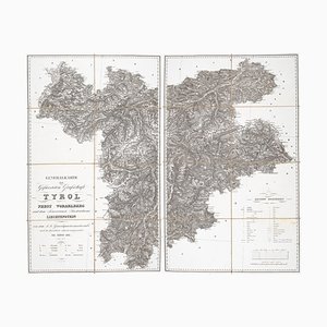
Detailed Map of Tyrol, Vorarlberg and Liechtenstein
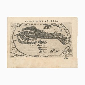
First Issue of Rosaccios Map of Venice
Fantasy Map of Asia as Pegasus

Map of Mungo Park's Search for the River Niger

16th Century Italian Map of Cambridge

16th Century Miniature Map of Cyprus

Large and Detailed Chart of the Bahamas, 1700s

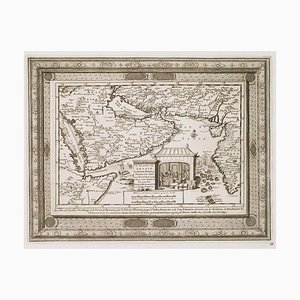
Map of the Persian Gulf

The City and Whitechapel from a Large-Scale Survey of London

Covent Garden and Soho from a Large-Scale Survey of London

Pimlico and Belgravia from an Important Large-Scale Survey of London

18th Century Map of Arabia with a Fine Border
19th Century American Sea Chart of Hong Kong

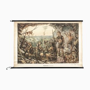
Charts of Maps from Ice Age Man
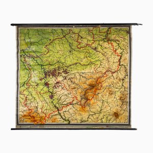
Charts of Physical Maps from North Rhine Westphalia NRW
Heart Ex Voto Go Behind by Miho

Ex-Voto Heart Be Brave by Miho

18th Century Map of the Island of Madagascar
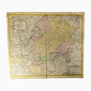
18th Century Hand Colored Engraved Map of Germany S.R.I Circulus Rhenanus
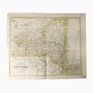
Antique Hand Colored Map of New York State from 1842
Vintage Wall Chart by Jung, Koch & Quentell for Hagemann, 1970s
Vintage Wall Chart by Young, Koch & Quentell for Hagemann, 1970s
School Poster by Jung, Koch & Quentell for Hagemann, 1960s
Plan d'Etupes N°3 Chart, 1833
Old Map of Etupes, 1833
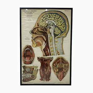
American Frohse Anatomical Chart, 1947
American Red Cross Map of Italy, First World War, 1919

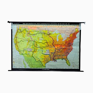
Vintage United States Mural Map, 1979
Antique Naval Map of Australia, 1888

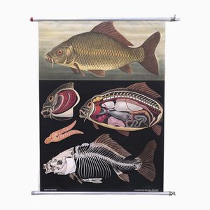
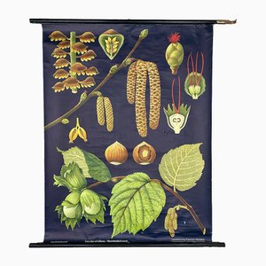
Quentell Carp Chart by Jung Koch
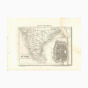
Original Lithographic Map of India, 19th Century
Wall Decoration Map, 1833
Les Chemins de Mr Deschamps Chart
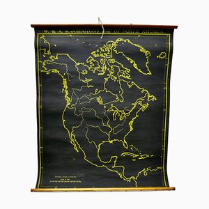
Black University Chart Map of North America, 1920s
Vintage Wall Card Teaching Table by Linde Jung, Koch, & Quentell for Hagemann, 1970s
Vintage Teaching Board in Cherry by Jung, Koch & Quentell for Hagemann, 1970s
Vintage School Board by Jung, Koch & Quentell for Hagemann, 1970s
Vintage School Board by Young, Koch & Quentell for Hagemann, 1970s
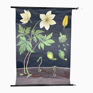
Vintage Wall Card Teaching Table Anemone by Jung, Koch & Quentell for Hagemann, 1970s
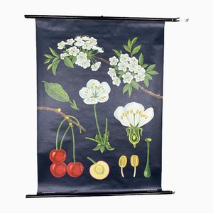
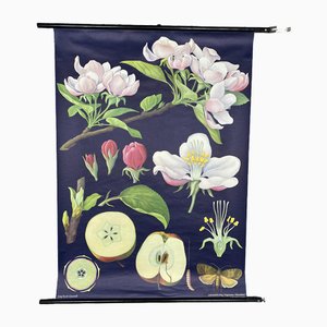
Vintage School Wall Card School Poster Edler Apple Tree by Jung, Koch & Quentell for Hagemann, 1970s
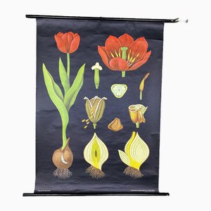
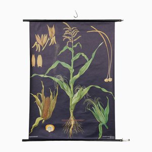
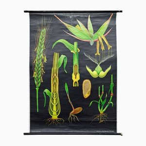
Botanical Corn Wall Chart by Jung, Koch, & Quentell for Hagemann, 1960s
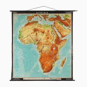
Large Africa School Map, 1950s
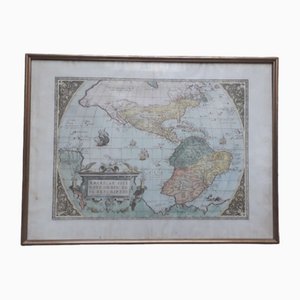
Antique Watercolor Print Map or the Americas, 1890s
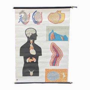
Pull-Down Chart of Endocrine System, 1970s
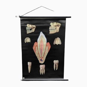
Pull-Down Chart of Human Teeth, 1960s
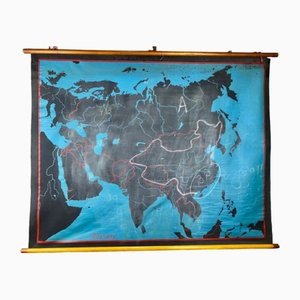
Beech Asia Map, 1940s
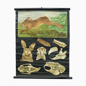
Hare Rabbit Countrylife Wall ChartJung Koch Quentell, 1960s
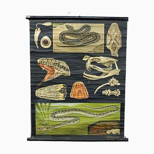
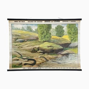
Snake Serpent Wall Chart from Jung Koch Quentell, 1960s
Vintage Pull-Down Wall Chart, 1970s
Vintage Rollable Wall Chart, 1970s
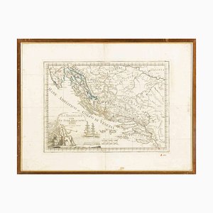
Giovanni Mignani, Map of Dalmatia & Adjacent Islands, Etching, 1792, Framed
Vintage Jung Koch Quentell Mural Countrycore Wall Chart, 1970s
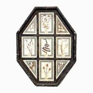
Vintage Herbarium in Glazed Wooden Frames, Florence, 1941
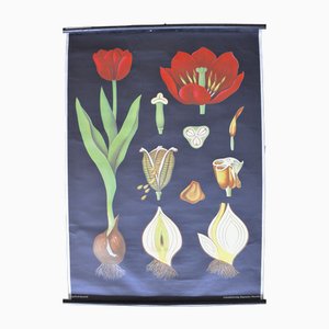
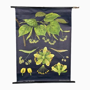
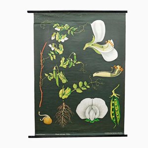
Vintage Cottagecore Botanic Wall Chart by Jung Koch Quentell
Charles XII Plan of Narva and Ivangorod During the Northern War
Retro Protozoa Pull-Down Wall Chart Animal Poster by Jung Koch Quentell
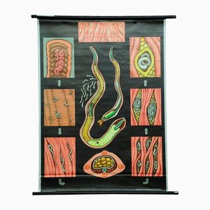
Tapeworm Rollable Wallchart by Jung Koch Quentell
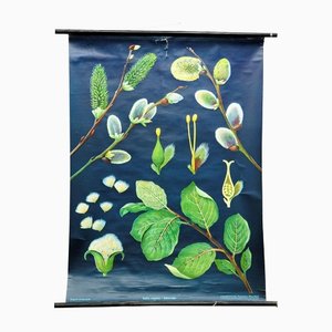
Pussy Willow Salix Caprea Wall Chart Picture Poster by Jung Koch Quentell
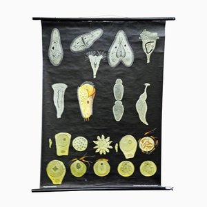
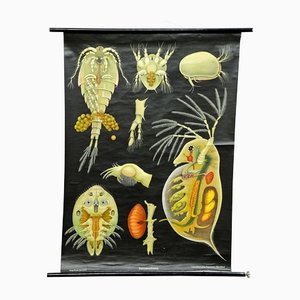
Entomostraca Animal Poster Print Pull-Down Wall Chart by Jung Koch Quentell
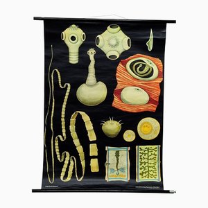
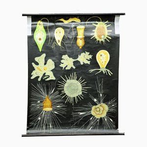
Flagellates Root-Feet Animal Rollable Wall Chart by Jung Koch Quentell
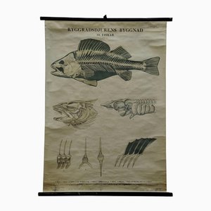
Vintage Swedish Black and White Skeleton of a Fish Rollable Wall Chart
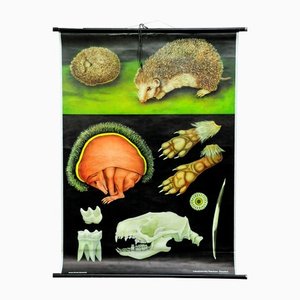
Vintage Hedgehog Rollable Wall Chart Poster Print by Jung Koch Quentell
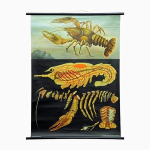
Vintage Deco Crayfish Maritime Poster Pull-Down Wall Chart by Jung Koch Quentell
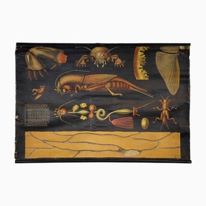
Antique European Mole Cricket Gryllotapla Rollable Wall Chart by Jung Koch Quentell
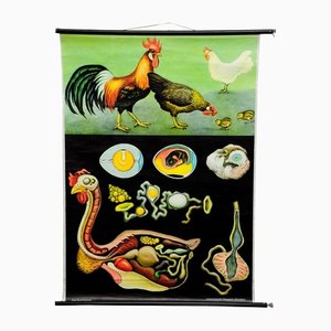
Vintage Country Style Chicken Hen Pull-Down Wall Chart by Jung Koch Quentell
Trichina Rollable Poster Print Wall Chart by Jung Koch Quentell
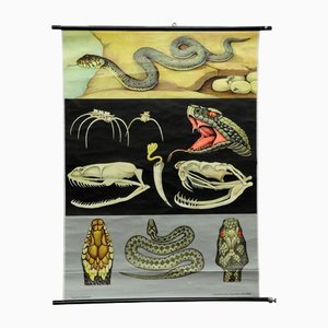
Vintage Reptiles Grass Snake Adder Picture Poster Wall Chart by Jung Koch Quentell
Vintage Tapeworm Parasite Medical Pull Down Wall Chart
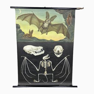
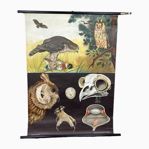
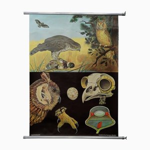
Goshawk Buzzard Long-Eared Owl Rollable Wall Chart Poster by Jung Koch Quentell
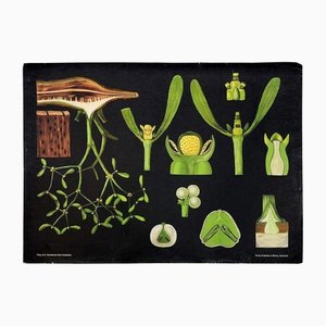
Antique Mistletoe Christmas Decoration Wall Chart Poster by Jung Koch Quentell
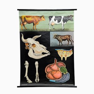
Vintage Deco Cattle Cow Anatomy Art Print Wall Chart Poster by Jung Koch Quentell
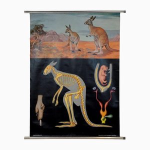
Vintage Kangaroo Australian Landscape Pull Down Wall Chart by Jung Koch Quentell
Vintage Rye Rollable Wall Chart Picture Poster by Jung Koch Quentell
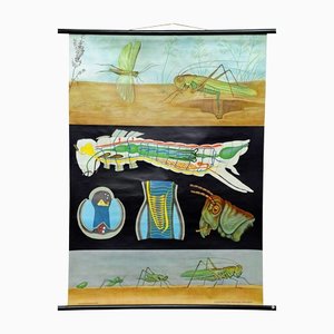
Vintage Biology Animals Bush Cricket School Wall Chart by Jung Koch Quentell
Vintage Biology Animals Carp Maritime Decor School Wall Chart by Jung Koch Quentell

Trending