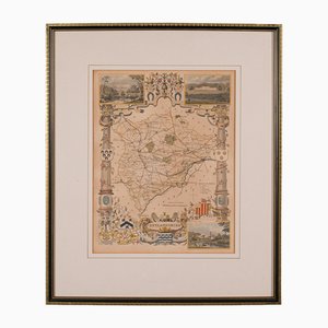
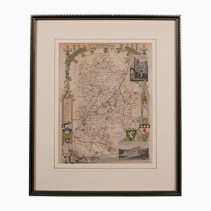
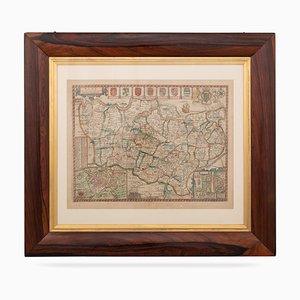
Antique English Rutlandshire County Map, 1860s
$442
You are now following Charts. You can manage alerts in your account settings.
You have unfollowed Charts.
Antique English Rutlandshire County Map, 1860s
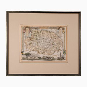
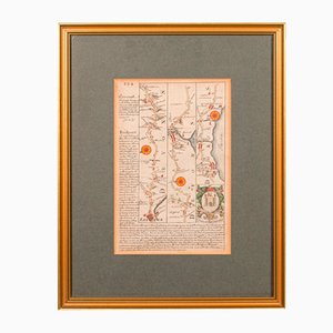
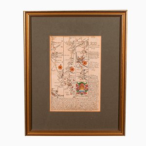
Antique English Framed County Map
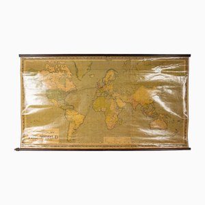
Large Scrolled Map of the World by Philips, 1918
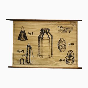
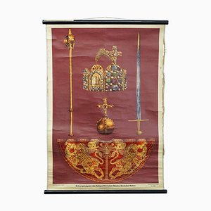
Vintage Educational Board Milk by Georg H. Knickmann, 1940s
Antique English Isle of Thanet Lithography Map
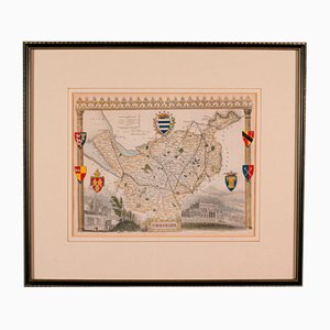
Antique Lithography Map of Cheshire, England
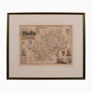
Antique Framed Lithographic Map of Hertfordshire, England
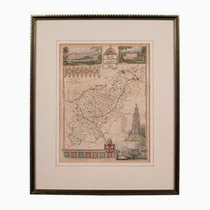
Antique Framed Lithographic Map of Northamptonshire, England, 1860
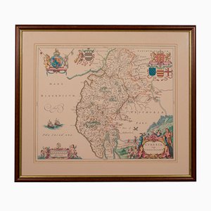
Antique Framed Lithographic Map of Bedfordshire, England
Antique English Chart of Devon
Antique English Coaching Road Map
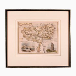
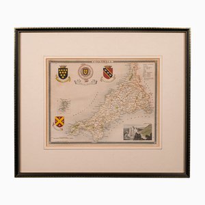
Antique English Lithography Map of Cornwall, 1850s
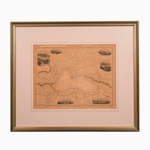
Antique English Lithography Map of Black Sea
Antique English Lithography Map
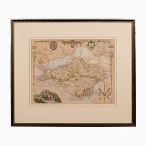
Antique English Lithography Map of Isle of Wight
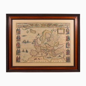
Vintage Reproduction of 17th Century Map of Europe, 1970s
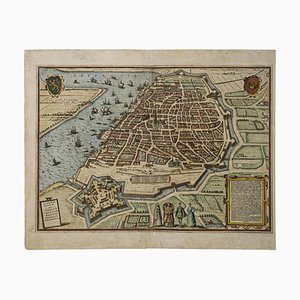
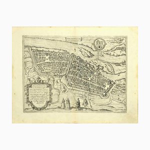
Franz Hogenberg, Map of Antwerp, Etching, Late 16th Century
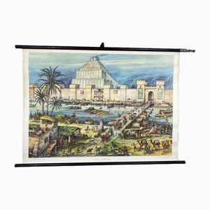
Vintage School Wall Card Print Live in Babylon Posters
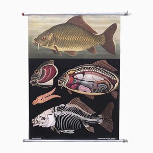
Quentell Carp Chart by Jung Koch
Räuvögel Chart by Jung Koch Quentell

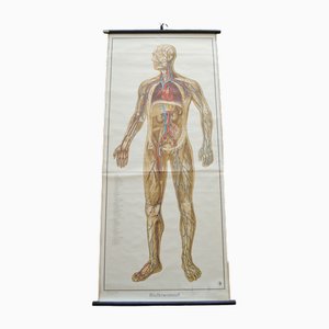
Blood Circulation Anatomic Wall Chart from German Health Museum Cologne, 1952
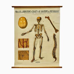
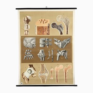
Large University Anatomical Bones Chart by Turner, 1920s
Vintage Landscape Wall Chart, 1970

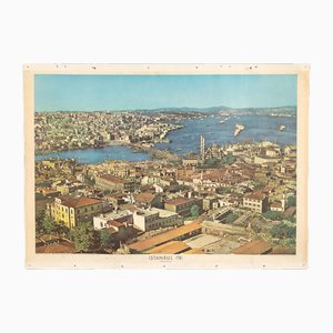
City Istanbul School Wall Panel, 1960s
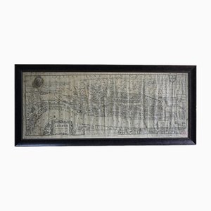
Printed Birds-Eye View of Tudor London
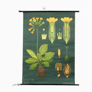
Vintage Botanical Wall Chart by Jung, Koch, & Quentell for Hagemann, 1960s
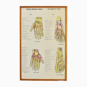
Vintage French Anatomy Chart- Hand & Foot, 1960s
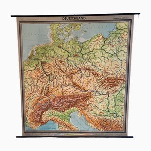
Large Vintage German Linen School Map of Central Europe, 1960s
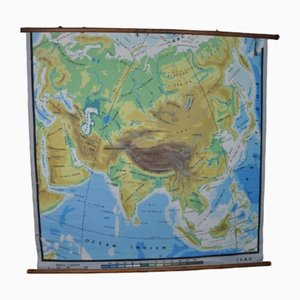
Physical Map of Asia, 1960s
Beech Asia Map, 1940s
Vintage Mural Wall Chart, 1970
Maikchafer Botanical School Chart from Jung, Koch & Quentell for Hagemann Düsseldorf, 1970s

Map of Magdeburg Etching by G. Braun & F. Hogenberg, Late 16th Century
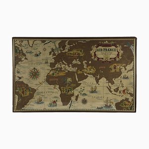
Air France Nova and Vetera Poster Map by Lucien Boucher, Paris, France, 1939
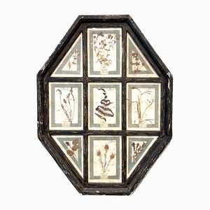
Vintage Herbarium in Glazed Wooden Frames, Florence, 1941
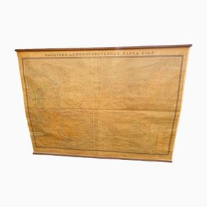
School Map of the Soviet Union, 1960s
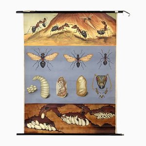
Biological Chart Depicting Wood Ant by Jung, Koch & Quentell, 1960s
Anatomical Construction of the Bone Chart, 1960s
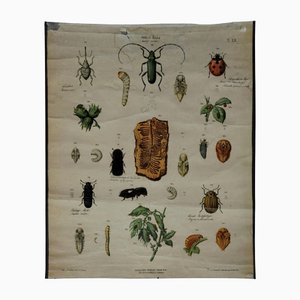
Old Vintage Beetles Insects Overview Wall Chart Poster
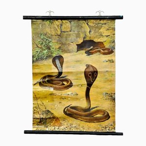
Scenery with Cobras Snake Poster Print Pull-Down Wall Chart
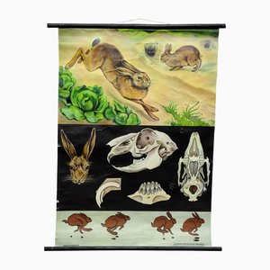
Brown Hare Common Rabbit Wall Chart Poster by Jung Koch Quentell
Educational Pull Down Biology Chart by Jung Koch Quentell, Germany, 1969

18th Century Map of the County of York by Emanuel Bowen, 1740s
17th Century Map of Kent with Her Cities & Earles Described by John Speed, 1670s
Franz Hogenberg, Map of Rouen, Etching by G.Braun and F. Hogenberg, Late 16th Century
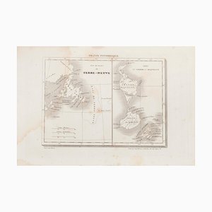
Unknown - Map of Terre Neuve - Original Etching - 19th Century
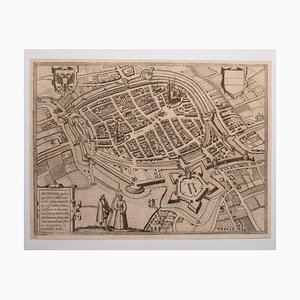
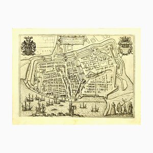
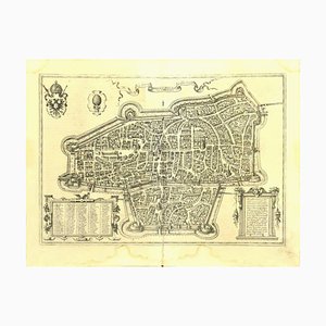
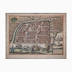
George Braun - Map of Groningen - Original Etching - Late 16th Century
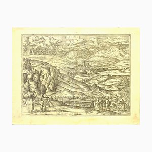
Franz Hogenberg - Map of Alhama - Etching - Late 16th Century
Franz Hogenberg - Map of Innsbruck - Etching - Late 16th Century
Franz Hogenberg - Map of Embden - Original Etching - Late 16th Century
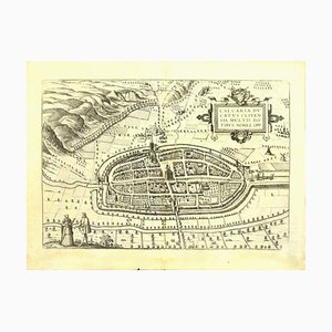
Franz Hogenberg - Price - Map of Kalkar - Etching - Late 16th Century
Franz Hogenberg - Map of Magdeburg - Etching - Late 16th Century

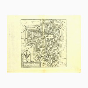
Franz Hogenberg - Map of Ypres - Etching - Late 16th Century
Franz Hogenberg - Map of Augsburg - Etching - Late 16th Century
Franz Hogenberg - Map of Nijmegen - Etching - Late 16th Century
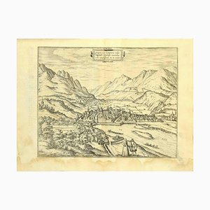
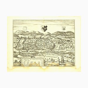
Franz Hogenberg - View of Kempten in Allgau - Etching - Late 1500
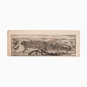
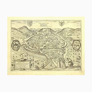
Franz Hogenberg - View of Vesontio - Etching - Late 16th Century
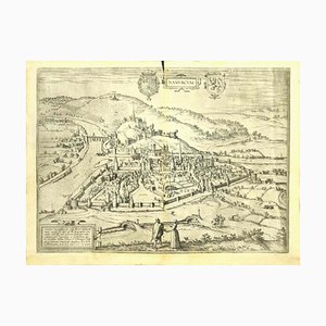
Franz Hogenberg - View of Namur (belgium) - Etching - Late 1500
Franz Hogenberg - View of Gorlitz - Etching - Late 16th Century

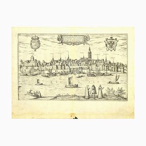
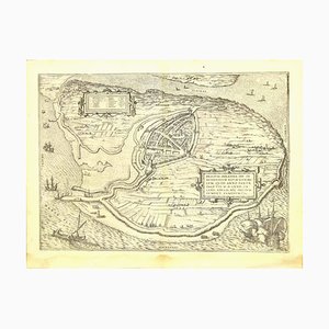
Franz Hogenberg - Brielle Den Briel - Etching - Late 16th Century
Moscow /Moscovia Antique Map, Civitates Orbis Terrarum by Braun and Hogenberg 1572-1617
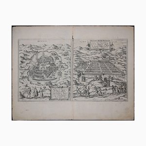
Mexico City & Cusco Antique Map, Civitates Orbis Terrarum by Braun & Hogenberg 1572-1617
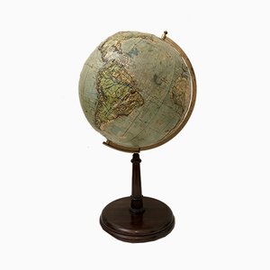
Antique Globe by Hammet and Bacon, 1910s

Vintage Relief Globe from Vallardi
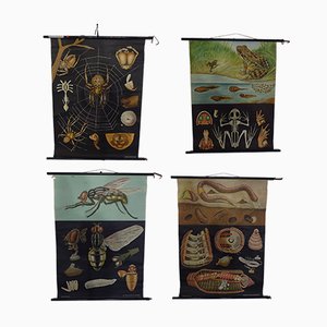
Austrian Educational Charts from Jung, Koch & Quentell, 1960s, Set of 4
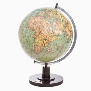
German Art Deco Globe from Columbus Verlag, 1941
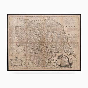
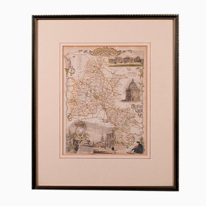
19th Century English Oxfordshire Country Map
Trending